A global map of socio-environmental conflicts and justice movements related to aviation-related projects includes 60 cases that have already been analyzed. The map provides a wealth of information on how people and the environment can be negatively impacted by new airports and expansion of existing airports. Affected communities contend with a multitude of injustices: eviction, land dispossession, loss of farmland and fishing grounds, destruction of ecosystems, construction work impacts and health damage from aircraft pollution and noise once airport projects become operational. More than 300 such cases around the world have been registered in the research project, conducted by the EnvJustice project and the Stay Grounded network.

Several aerotropolis or airport city projects, i.e. substantial commercial and/or industrial development constructed or planned on land surrounding or adjoining an airport, are documented and analyzed. Examples include Kertajati Airport and New Yogyakarta International Airport in Indonesia, both of which involved forcible eviction of communities from several villages from their homes and farmlands. In Cambodia, the government has approved a plan for a new Phnom Penh Airport, one of the world’s largest airports by land area, along with an associated ‘airport city’. The proposed site, predominantly agricultural land, encompasses land that Kandal Stueng villages have resided on for two decades, including communally held wetlands. About 2,000 families could be affected and hundreds of people have protested against the development.
In India, Andal Aerotropolis is a private airport city development that was stalled by sharecroppers protesting delays in receiving compensation for land taken for the project. Landowners from seven villages in Purandar sustained resistance against loss of their homes and farmland for a new airport since the location of the project was announced in 2016. Then in 2018 it was reported that the state government was forming a consortium to drive investment in an ‘airport city’ around the airport. Villagers’ resistance against displacement from their farmland for Bhogapuram Aerotropolis, also referred to as an ‘aerocity’, succeeded in reducing the land area allocated to the project from 6,000 hectares to 1,122 hectares, along with securing higher compensation for a group of farmers.
A plan for a new airport on the Arial Beel wetlands in Bangladesh is an example of a aerotropolis-type megaproject that was halted by mass mobilisation. A vast swath of land had been earmarked for development, 10,117 hectares for the airport and an accompanying ‘satellite city’, and the farming and fishing livelihoods of thousands of people were set to be seriously affected with wetlands paved over. The government cancelled the project after major protests, the largest of which involved 30,000 people. In the Philippines, mangroves, coastal wetlands providing a vital habitat for many species and protection from erosion and flooding, have already been destroyed to make way for the proposed Bulacan Aerotopolis which threatens to destroy fishing livelihoods. Airport projects can entail deforestation. In Nepal, the proposed Nijgadh Airport, a massive 8,000 hectare aerotropolis, raises the prospect of over 2.4 million trees being felled.
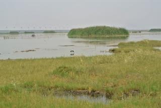
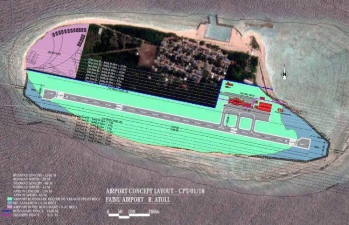
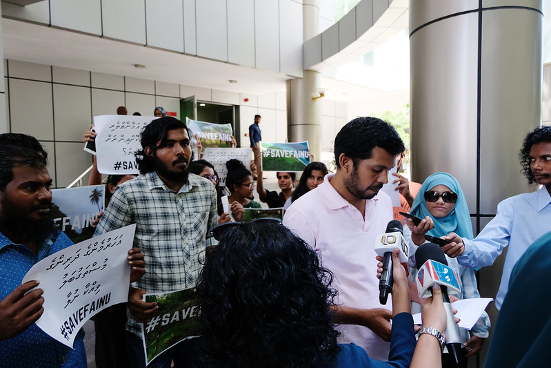
A number of airport projects shown on the map are key components of tourism development schemes that are based upon aviation dependency. A proposed new airport on the Island of Fainu, in The Maldives, is accompanied by a plan for an adjoining hotel. The project would destroy a long stretch of white sand coastline, dense forest and agricultural land, the airport and hotel projects combined swallowing up much of the small island. Another example is the Philippine island of Sicogon where, in the aftermath of the devastation wreaked by Typhoon Yolanda, developers seized upon the opportunity for tourism development, the first phase of which includes an airport specifically for tourism along with beachfront accommodation. Disaster capitalism is also evident in the Caribbean island of Barbuda where land clearance for construction of a new airport, intended to support tourism growth in particular high-end resorts, began shortly after residents were evacuated following Hurricane Irma.
The map includes two major airports built to support fossil fuel projects. Uganda’s second international airport, Hoima Airport, currently under construction, is a key component of the 29 square kilometre Kabaale Petrochemical Industrial Park. With a 3.5 kilometre length runway, capable of accommodating the world’s largest cargo aircraft, it is envisaged that in its first phase of operations Hoima Airport will handle delivery of heavy equipment for the oil refinery on the site. In a similar vein, Komo Airfield, in the southern highlands of Papua New Guinea, has the country’s longest runway and was built for delivery of heavyweight and outsize equipment for the ExxonMobil led PNG LNG (liquefied natural gas) project.
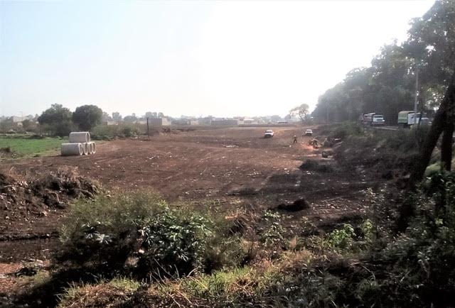
A number of cases shown on the map involve allocation of larger areas of land than would be required for aviation operations, increasing the number of people potentially facing displacement due to land acquisition, but without clear information on what the excess land might be utilized for. For example, in Nigeria the Cross River State government intends to acquire 900 hectares of land for a proposed Obudu International Passenger and Cargo Airport and people have been evicted from their homes and farmlands. In a similar case in Nigeria, bulldozers arrived without warning to clear 4,000 hectares of farmland where crops including cocoa, palm trees and bananas were cultivated for a cargo airport in Ekiti. This airport project is one instance of a successful court case where affected people secured a court victory that halted the airport project. Also in Nigeria, about 5,000 people from 20 villages could be affected by a proposed Ogun cargo airport and hundreds of farmers protested against land-grabbing.
The map of aviation-related conflicts and environmental justice movements is an ongoing project in development coordinated by the EnvJustice (ICTA-UAB) project and the Stay Grounded network. In addition to the 60 airport-related cases already included, a great many further cases have been registered as meriting further investigation. A total of 300 cases have been registered. The information gathered for the global map has been provided by a wide variety of organizations, local collectives and academics. The research team is coordinated by Rose Bridger (Stay Grounded) and Sara Mingorria (ICTA-UAB). This already substantial database and interactive map related to airports is part of Ejatlas, the biggest global inventory of socio-environmental conflicts around the world. As of 11th July 2019 2,831 cases were registered on Ejatlas and this is anticipated to increase to 3,000 cases by the end of the year.

 A mega-airport is planned, handling 10 million passengers annually upon completion of the first phase, rising to