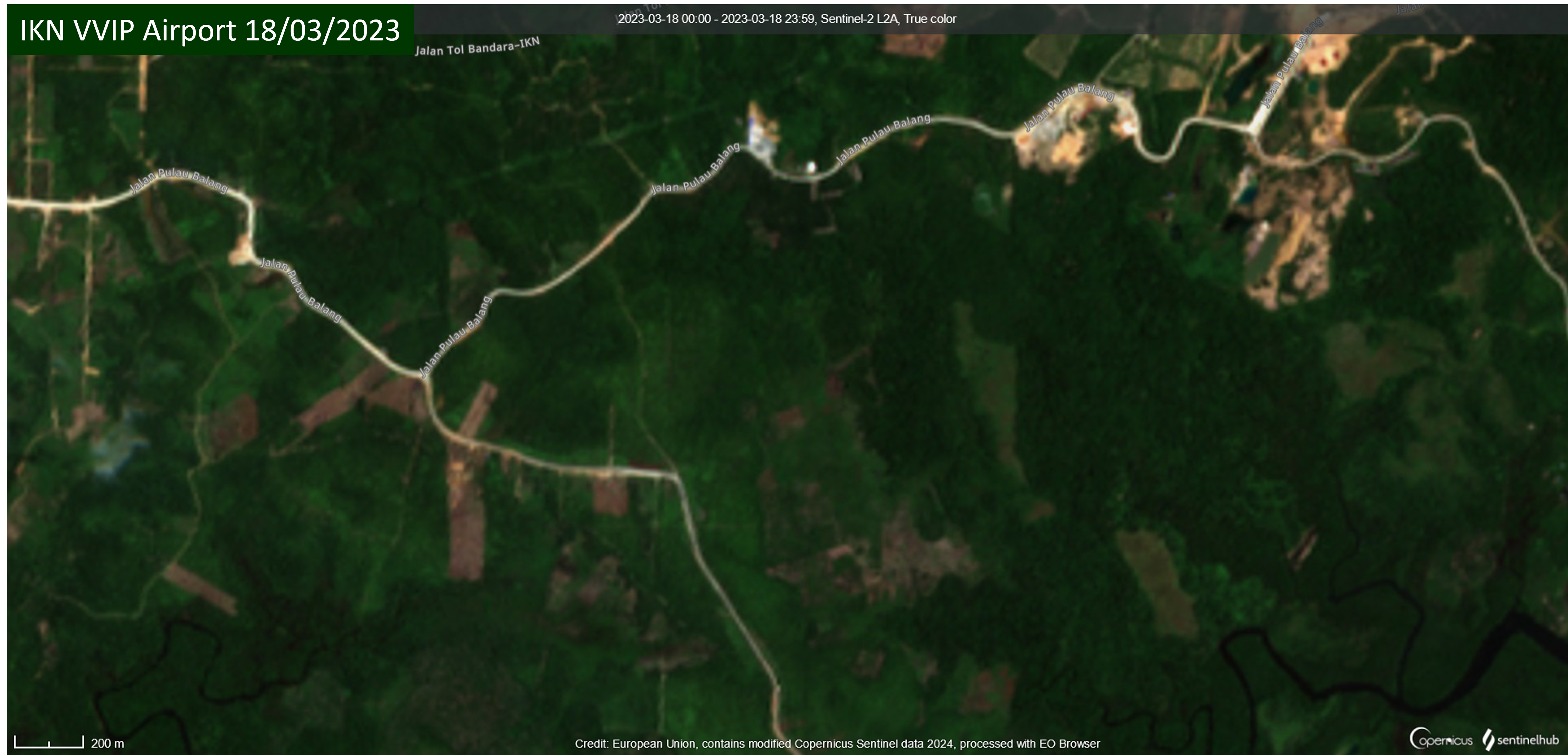
In East Kalimantan on the east coast of Borneo a new VVIP (Very Very Important Person) airport is being constructed to support development of Nusantara (IKN), the future capital city of Indonesia. With a VVIP and VIP terminal covering an area of 7,350 square metres and three helipads IKN VVIP Airport will support the mobility of the President, high-ranking officials, state guests and investors. The international airport will have a 3,000 metre runway to accommodate Airbus A400 military aircraft and will be used in coordination with the Indonesian Air Force (IAF). Development of IKN VVIP Airport was accelerated by Presidential Regulation No. 31 on 6th June 2023.
Satellite imagery shows land clearance and earthworks. The image on the left is from 18th March 2023 before works began. On the right is an image from 16th February 2024 where development of the IKN VVIP Airport terminal, runway and access road are clearly visible.
Demarcation of a 360-hectare site began within a few days and triggered reaction from some affected residents. On 30th June Muslimah News reported that hundreds of residents from five sub-districts – Gersik, Jenebora, Pantai Lango, Kelurahan Riko and the Maridan village area in Sepaku – were protesting take-over of land they occupied by the Land Bank Agency for construction of the VVIP airport. They refused to hand over their land to the Land Bank Agency because stakes were installed without prior notice and the government’s promise, made the previous year, to provide land for agrarian reform had not yet been fulfilled. There was a lot of evidence that construction was consuming residents’ land and authorities were ignoring their protests. Protest was not just in response to construction of the airport; there was also some controversy over whether the land bank serves public interest or corporate projects. The Land Bank Agency made reassurances that residents’ rights to replacement land would be accelerated and that agrarian reform land was being prepared for this purpose.
On 3rd August 2023 many palm farmers gathered at their former plantation area where they unfurled banners and made speeches demanding compensation for land affected by the VVIP airport construction project. A lawyer representing some of the residents said that oil palm land previously managed by them was suddenly cleared with heavy equipment. Palm oil trees had been damaged and razed to the ground but the farmers said they had not received compensation and there had been no discussions or meetings with authorities.
Land clearance and installation of boundary markers continued and on 10th January 2024, during socialisation for communities impacted by construction of the VVIP airport and access toll road, it was announced that 400 hectares of replacement land had been prepared for them. Yet complaints about the land acquisition process continued. On 14th January 2024 TribunKaltim reported that some farmers whose land was used for construction of the VVIP airport were unable to farm the land and had no clarity regarding replacement land. The land declared for the airport was the only land they owned and they relied upon it for their livelihoods. Many affected farmers owned one or two hectares of land. Many residents who lost their land had still not received compensation.
On 9th February 2024 Acting Regent of North Penajam Paser, Makmur Marbun, said the number of people whose land was allocated for the VVIP airport but had not yet been acquired had reduced from 80 to 22, explaining that the land of these 22 people is in the area that will be the runway and vital for the airport project. The residents had brought a lawyer to the airport site where they met with officials but Makmur Marbun said he would continue to attempt to resolve the issue through discussions. Completion of IKN VVIP Airport and commencement of operations is targeted for early August 2024.
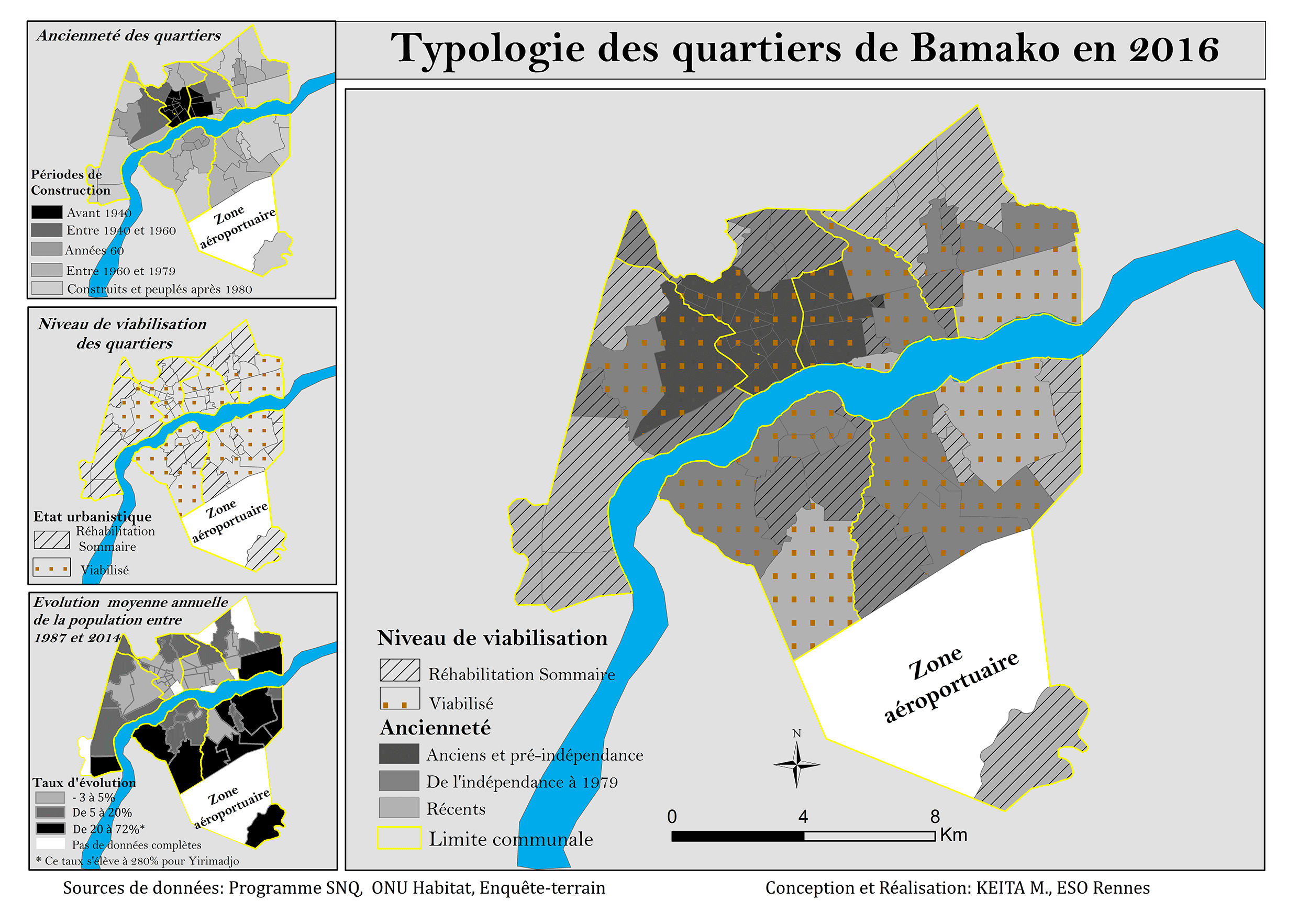
Mass evictions for an ‘airport zone’ next to Modibo Keita Airport, Mali’s main airport on the outskirts of Bamako, the capital city, began on 20th April 1995. Without warning, the government began bulldozing the Senou neighbourhood to make way for expansion of the zone. Demolitions continued for ten days and about 3,707 families, approximately 30,000 people, were forcibly evicted. Further waves of demolitions followed with many instances of land grabbing and speculation. Farmers were displaced for a fertilizer plant on the land in 2007-8 and in 2009 residents resisted instructions to leave the land. A drive to clear remaining communities began in 2021. Bulldozers arrived early in the morning of 14th January, in a major eviction drive covering 1,600 hectares; about 20,000 families in 11 neighbourhoods were impacted. About 800 evictees said they had permits to occupy the land and many affected people were left destitute without shelter.
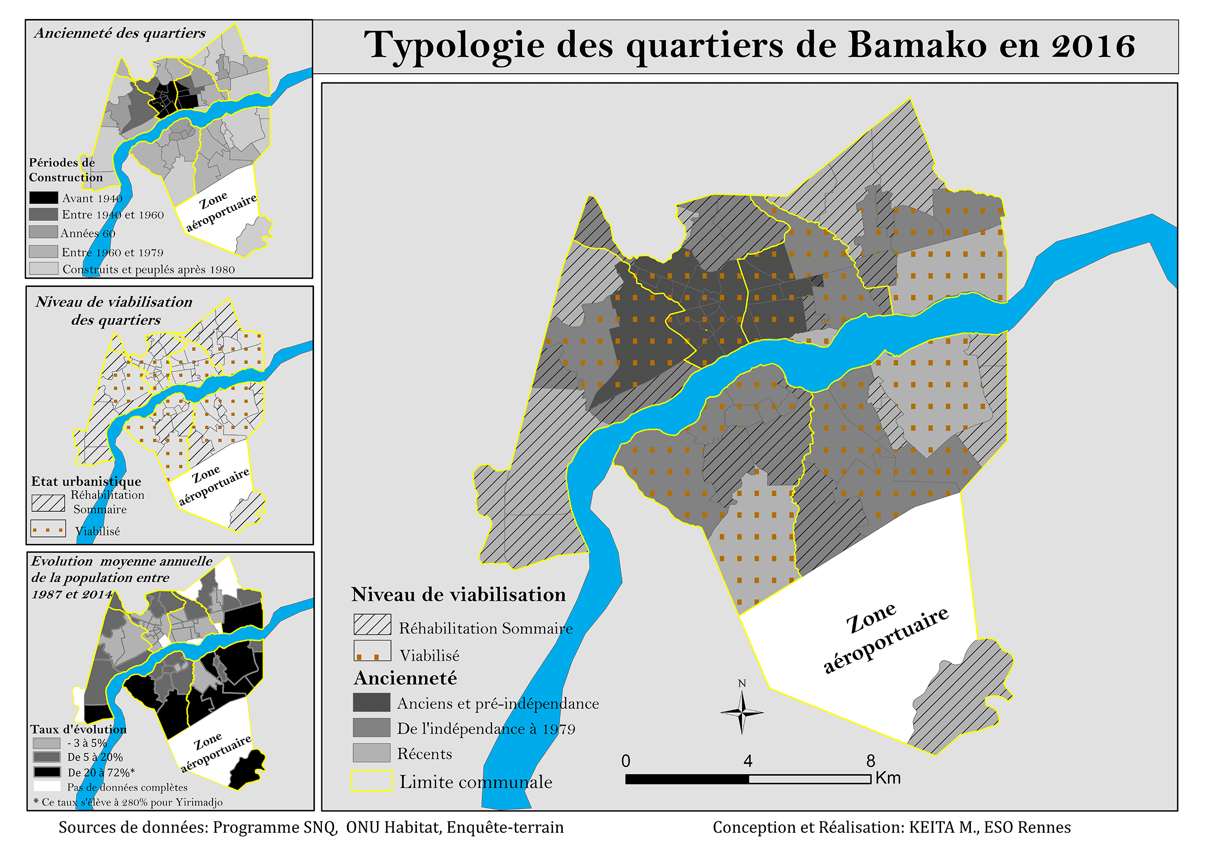
The ‘airport zone’ – zone aéroportuaire Modibo Kéita – is vast, extending over 7,194 hectares northwest of the airport. It was classified as a plot of land for airport company use in 1999. Residents contest government claims that their occupation of the airport zone is illicit; they have lived on the land for several generations. An inhabitants’ organization – Plateforme deshabitants de la zone dite aéroportuaire (PHZA) – has been established with active groups, sometimes holding different views about land management, in many affected villages. Women, some of them elderly, play a prominent role in resistance against eviction from the ‘so-called airport zone’. The land struggle is supported by l’Union des Associations et Coordinations d’associations pour le Dévelopement et la Défense des Droits des Démunis (UACDDDD), a national federation fighting the injustices of dispossession. Demonstrations and meetings about the airport zone have been attended by hundreds of people. In November 2021 an independent national commission of inquiry to investigate demolitions in the airport area was established.
For more information about the Modibo Keita airport zone evictions see the case report on EJatlas, the world’s largest, most comprehensive online database of social conflict around environmental issues: Modibo Keith airport zone, Mali
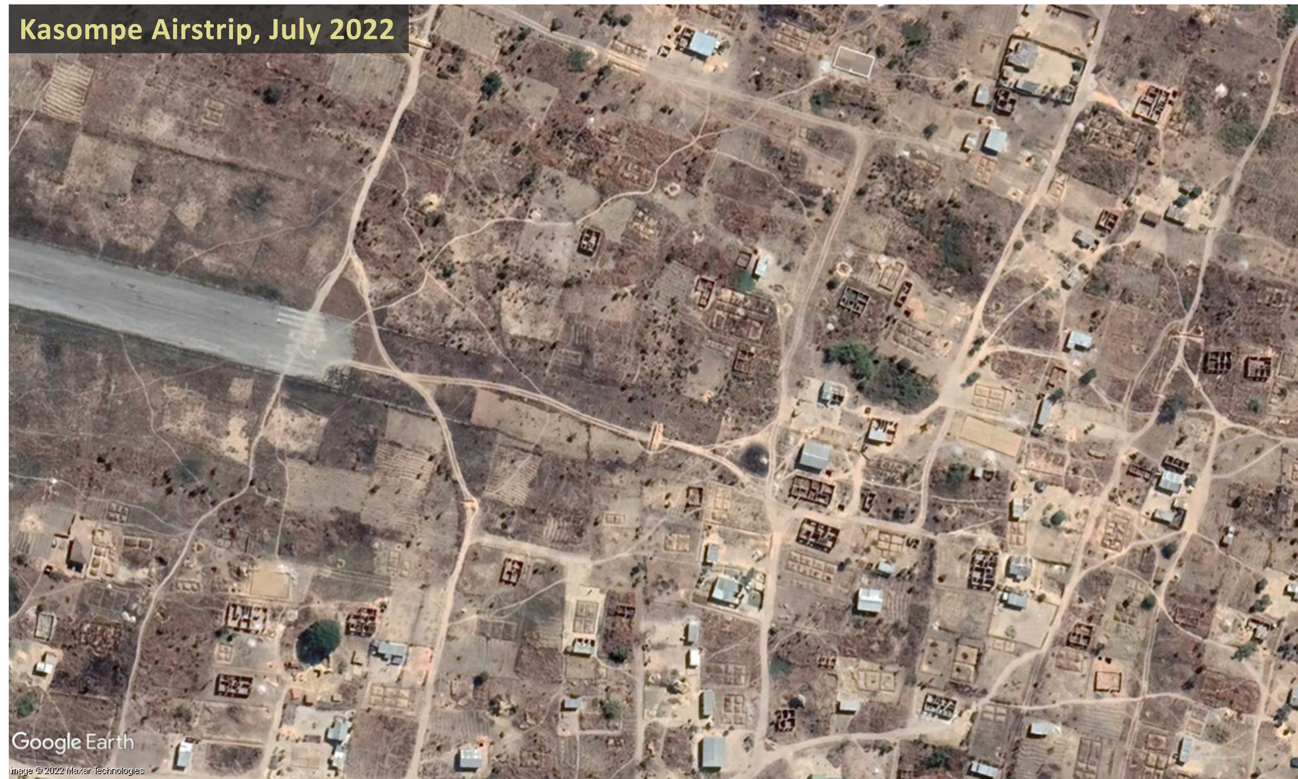
On 20th August 2022, beginning at 2am, more than 300 houses built on land surrounding Kasompe Airstrip were demolished by officers from Chingola Municipal Council and the Zambia Police Service. The Council stated it had not allocated the land in question and the buildings had been erected without planning permission. Residents appealed to the government to find them alternative land and some of them attempted to resist the demolition, burning tyres and breaking the windows of bulldozers. A video of the demolition shows houses in plots of land with gardens and trees being bulldozed, as displaced people looked on.
Completed houses as well as houses still under construction were demolished. A number of residents retaliated against destruction of their homes, setting fire to two properties – a guesthouse and servants’ quarters – owned by Johnson Kang’ombe, Mayor of Chingola, whom they accused him of selling them plots of land at Kasombe Airstrip. Two suspects thought to be involved in the arson were apprehended and detained. A group of women protested chanting slogans including “The Mayor must go”. One evicted woman said that her aunt whose home was also demolished had collapsed with suspected high blood pressure.
In the aftermath of the demolitions the only help given to displaced residents was food aid and space in a camping site, provided by the Chingola District Disaster Management and Mitigation Unit (DMMU). On 29th August it was reported that Chingola District Commissioner Raphael Chimupi had said that DMMU had given relief food items to 95 out of 98 families whose houses had been demolished. Chingola Member of Parliament Chipoka Mulenga visited affected residents and promised to help them, saying “I will do everything in my power to help resolve this issue, it is saddening to see a lot of houses demolished, which has left many families in the cold.” Mulenga said the government would provide alternative land to the victims of the demolition of 345 houses, but as of 27th September 2022 some people were still stranded with nowhere to relocate to.
Satellite imagery of an area at the eastern end of the Kasompe Airstrip runway, dated 26th July and 8th September, shows some of the buildings which were destroyed on 20th August 2022. Slide the bar between the images below to compare the area before and after the demolitions.
The land conflict, inustice and human rights violations related to Kasompe Airstrip is documented on EJAtlas, the world’s largest, most comprehensive online database of social conflict around environmental issues. Kasompe Airstrip is located on the eastern outskirts of the city of Chingola, in the Copperbelt Province, a mineral rich area that is the main copper mining region in Zambia. President of the Equity and Economic Party, Chilufya Tayali, said information had surfaced indicating that the demolition of the houses was not driven by the purported illegality of allocation on plots of land but by foreign interests in a mine near Kasompe Airstrip. Aerotropolis-type plans were mentioned in 2019 when the then Mayor of Chingola, Titus Tembo, said Chingola aims to become a city with Kasompe Airstrip being part of this agenda.
The Zambia Air Force (ZAF) denied allegations that it has influenced or pressured Chingola Municipal Council to demolish the houses on Kasompe Airstrip land. ZAF Director Public Relations Lieutenant Colonel Helen Chota said rumours were incorrect and that none of the other ZAF airstrips had been encroached. Yet the day after the demolitions, on 21st August 2022, it was reported that ZAF Commander Lieutenant Colon Barry had alerted citizens to more house demolitions across the country, saying houses and other structures built within 500 metres of airport infrastructure would be demolished and that building civilian structures on or near airports is a threat to national security.
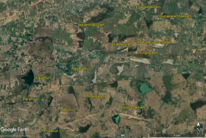
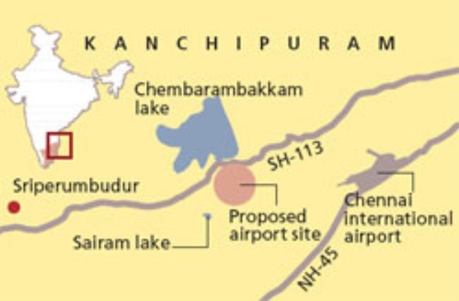
Thousands of farmers and residents have urged the Tamil Nadu state government and Central government of India not to implement a proposed second Chennai airport in Parandur that would destroy their agrarian activities and livelihoods. Parandur is an agricultural area in the Kanchipuram district and the State government plans to acquire land in 12 villages for the airport project. The proposed site in Purandur is approximately 57 kilometres eastwards of the existing Chennai Airport and to the north of the Chennai-Bangalore national highway which is being constructed in stages. Below is a slideshow of a map of the proposed airport site and Google Earth satellite imagery showing several of the villages that might be impacted by land acquisition.
A Times of India article states that the 12 villages from which land for the airport will be acquired are: Parandur, Valathur, Nelvoy, Thandalam, Polavur (Podavur), Madapuram, Ekanapuram, Akkammapuram, Singilipadi, Mahadevi Mangalam, Gunakarambakkam and Edayarpakkam. Other villages to be impacted by land acquisition are listed in other sources referenced in this blogpost, namely Nagapattu, Koothavakkam, Uthyarpakkam and OM Mangalam.
Concerns over acquisition of farmland and environmental issues
On 1st August Union Minister of State for Civil Aviation Vijay Kumar Singh announced that the Parandur site has been finalised after consultation with the Tamil Nadu government. Some Purandar residents demanded suitable replacement land and employment from the government in return for acquiring their land; others said that acquisition of their agricultural land will render them jobless as it is the only work they have known. Some villagers have spoken to media outlets about reluctance to give up their land and uncertainty over provision of compensation:
Ramasamy, from Ekanpuram village, said “A huge tract of our agricultural land would come under this project. We don’t want to lose our agricultural land for this project because farming is our sole source of livelihood.”
Jayakumar, a farmer from Singilipadi, said, “We have been living here for generations. We didn’t know that the airport is coming up here. No one has informed us. If the government suddenly takes away our homes and land, what would we do? Even if they provide compensation, we don’t know what that would be. I am shocked.”
Rajendran, a resident of Thandalam, said, “We are ready to give up land if needed. But we need assurance from the government about good compensation and employment.
Selvaraj from Parandur village said, “We’ve been here in the village for the last 50 years. As per the map released by the government, 5 villages would be destroyed for constructing a new airport. Even if the government gave us compensation for our land, we don’t know what to do for a living, since we know only farming. All of us are shocked by this decision and are planning for a big protest soon. Even last month, the district collector assured us that the airport would not be constructed in Parandur.”
Nachiyappan, a farmer from Koothavakkam, said, ”We are living by farming and if the government acquires our land what will we do for a living? I have small children and want to educate them and am the sole breadwinner for the family. The government will make all sweet talking, but in reality, nothing will happen and we will be the losers. We will protest strongly against this project that will destroy our livelihood as well as the flora and fauna of the area.”
A postgraduate in Economics from Koothavakkam, R. Bindu, said, “Around 800 houses would be demolished in the area and the agrarian economy will be totally destroyed. There are many people in this village who don’t have the patta or the legal rights of the land and they will be totally on the streets.”
Many villagers are employed by the Mahatma Gandhi National Rural Employment Guarantee Scheme (MNREGS) and are concerned that their livelihoods could be destroyed along with the agricultural fields.
An environmental expert pointed out several hydrological problems that might arise from construction of the airport, from decreased recharge of groundwater to deterioration of water quality and possible flooding during the monsoon. The 4,791-acre site is dotted with water bodies and a large proportion, 2,605 acres, is wetlands. A large number of migratory bird species, especially from eastern Europe, visit the site. Some of the birds fly south to Vedanthangal which would pose a bird strike risk to air traffic. Building a stable structure on wetlands would be challenging. Parandur has a lake where migrant birds – tufted ducks, flamingos and common pochards – are frequently spotted.
An airport on a 4,791-acre site, with a huge aerocity
The proposal is for the new airport, with two runways, to have capacity to handle 100 million passengers annually, almost five times higher than the capacity of the existing Chennai Airport, at 22 million passengers per year. Capacity at Chennai Airport is being increased to 35 million in a seven-year expansion project. The runways at the airport in Purandar would be larger than at Chennai Airport, enabling it to handle larger aircraft carrying more than 600 passengers. Tamil Nadu chief minister Muthuvel Karunanidhi Stalin said the initial estimated cost of the proposed airport is Rs20,000 Crore, more than USD2.5 billion. Details of the break-up of this sum, and the funding route, have yet to be made public.
A Times of India article states that ‘The plan is to develop a huge aero city with facilities for maintenance and repairs, aviation ancillary units, and commercial establishments’. Confederation of Indian Industry (CII) Tamil Nadu Chapter chairman Satyakam Arya has pushed for an aerocity around the new airport, which in addition to aviation related facilities could have a convention centre for global conferences and exhibitions. Shankar Vanavarayar, vice-chairman of CII Tamil Nadu, said the state may introduce special schemes and incentives for industries in order to spur industrialization from Chennai towards Parandur.
The proposed site for the Parandur airport, 4,791 acres (1,939 hectares), is certainly large enough to allocate a significant portion of the site for non-aviation facilities. It is larger than the world’s largest airport, Hartsfield Jackson in Atlanta USA, which, with five parallel runways and a site of 1,902 hectares, handled more than 110.5 million passengers in 2019, before traffic reduced worldwide due to the response to Covid-19. In addition to the 4,791-acre site a further 200 acres of land is required for construction of two airstrips, for which the process of surveys and land acquisition is likely to start soon.
Difficulties acquiring thousands of acres for the airport
Land availability has been the main hurdle stalling the second Chennai airport project since it was first mooted, in 1998. Many attempts at large-scale land acquisition failed until authorities zeroed in on Parandur and an article in The Hindu provides a timeline. In November 2000 a ‘futuristic terminal’ was anticipated on a 3,000-acre site likely to be at Porur in west Meenambakkam, north of the existing Chennai Airport. In May 2007 the then Chief Minister of Tamil Nadu, Muthuvel Karunanidhi, said that 4,820 acres would be acquired for the airport in Sriperumbudur. In 2016 the proposed greenfield airport, still planned in the vicinity of Sriperumbudur, was mired in land procurement problems. Union Minister of State for Civil Aviation Jayant Sinha said the thousands of acres required for the new airport were difficult to procure.
In January 2022 the Airports Authority of India (AAI) began to study four potential alternative sites identified by the State government: Pannur, Parandur, Padalam and Thiruporur. Subsequently this list was narrowed down to Pannur and Parandur. On 1st August 2022 Minister of State for Civil Aviation Vijay Kumar Singh said the Tamil Nadu government had shortlisted Parandur as the site for development of a second Chennai airport. The State government will now submit a proposal to the Ministry of Civil Aviation for ‘grant of site clearance’ for the finalised site. The State is also set to begin preparation of a detailed project report. Land acquisition is likely to begin once the State receives approval from the Centre. State government officials have confirmed they will conduct sittings in all affected villages allowing people to express their views to officials.
2010 protest against land acquisition in Sriperumbudur
The article with the project timeline in The Hindu does not mention that the 2007 identification of land for the airport in Sriperumbudur triggered mass protest by villagers resisting land acquisition. In 2010 Moverment against SEZs in Tamil Nadu reported that a 6,921-acre (2,800-hectare) site in Sriperumbudur, located eastward of Parandur and just 30 kilometres from Chennai’s existing airport, had been earmarked for a greenfield airport. The proposed land acquisition for the new airport threatened to displace 2,800 families, about 37,000 people, from 20 villages. Village representatives opposed the airport project and were not interested in compensation from the government. They said agriculture was viable in the proposed site where they cultivated rice paddies, mangos, jasmine trees and vegetables. The site also containing 77 lakes, 120 ponds and 10,000 trees which would be felled. Six village panchayats – Thirumanaikuppam, Vadamangalam, Vayalur, Thirupandiyur, Kottaiyur and Kiloy – passed resolutions opposing land acquisition in a gram sabha meeting.
Proposed site for a 2nd Chennai airport in Sriperumbudur, triggering mass protest in August 2010. Image: Down to Earth, 15/09/2010
Villagers drove away officials sent to survey the land on at least three occasions. On 12 August 2010, 3,000 people from 26 villages demonstrated against the project. Police attacked them with a lathi (baton) charge. Villagers who went to meet the District Officer and attempted to present a petition were beaten and around 20 of them had to be admitted to hospital. A jet fuel pipeline to Chennai Airport, routed through Sriperumbudur, seemingly hardwired the area for development of a new airport. Inaugurating the fuel pipeline in 2009 Praful Patel, Minister of State for Civil Aviation from 2004 to 2011, said, “This (pipeline) also passes through Sriperumbudur where another airport is planned. Once it comes up, the pipeline will be extremely useful.”
Plans for airport city style development at Nadzab Airport – located 42km to the northwest of Lae, capital of the Morobe Province and Papua New Guinea’s second largest city – emerged in a 2011 masterplan for future growth of the airport both as an aeronautical hub and as a commercial and industrial centre. Nadzab Airport’s extensive land holding was earmarked for development and expansion over a time-frame of 50-70 years. The graphic below, showing a business hub next to the airport, is from Nadzab Central Strategic Plan, produced by Planpac and identifying development opportunities for 700 hectares of greenfield land.
In 2012 PLANPAC developed a Strategic Land Use Masterplan for Nadzab Central Strategic Plan, a business hub next to Nadzab Airport, with 700 hectares of greenfield land on a 1,100 hectare site. Graphic: PLANPAC
Tensions between clans over ownership of land parcels date back to the inception of the airport project, in 1972 when the country was under Australian colonial administration. A loan agreement between the Japan International Cooperation Agency (JICA) and the PNG government – for ¥26,942 million (USD225.2 million) of an estimated project cost of ¥32,246 million (USD269.6 million) – was signed on 14th October 2015 and the project came to be known as Nadzab Airport Redevelopment Plan (NARP). Plans for an Airport City were mentioned in 2017 and in February 2020 NARP project manager said it was a major airport and city development and the provincial government must help address landowner issues. Prime Minister James Marape tasked Lands and Planning Minister John Rosso to start mobilising landowners in preparation for the project. In April 2021 PNG National Airports Corporation (NAC) managing director and chief executive Rex Kiponge said that upon completion of NARP the airport city concept would be rolled out, saying “When the airport is complete, the commercial aspects of the airport business hub must complement it.”
The village of Gabsongkeg is at the centre of NARP and landowners have made repeated calls for consultation, participation in the project and spin-off business opportunities. In 2020 landowners were disappointed that construction and security contracts were awarded to outsiders overlooking reputable local businesses. In January 2022 it was reported that only a small number of landowners were benefitting from leasing their customary land for associated businesses. Local people impacted by airport development still lack clean running water, electricity and adequate health facilities. NARP and other projects, such as a 4-lane highway and gold and copper mining, have triggered an influx of people, disrupting the social fabric and leading to increased social problems including violence, killings and drug & alcohol abuse. The area lacks a police station to address these issues.
Serious social problems of rape, underage marriage and prostitution specifically harm women. And women have been marginalized in land-related negotiations and decisions due to government assumptions of patrilineal land descent. Yet in the midst of these difficulties 60 Gabsongkeg women – planning ahead as most of the land in Gabsongkeg where coconut, plantain, cocoa and other trees are cultivated, is set to be taken over by the Nadzab township development – have established table markets selling food and other goods. They have increased their incomes and aim to grow their ventures into small-medium sized enterprises to support their families in the future.
Further information about contested land and other issues arising from Nadzab Airport has been published on EJatlas, the world’s largest, most comprehensive online database of social conflict around environmental issues: Nadzab Airport Redevlopment Plan (NARP) and Airport City, PNG
A drive to evict informal settlers living on parcels of land around Jacksons Airport, Papua New Guinea’s main airport located to the northeast of Port Moresby, was announced in the early days of 2022. Residents of the Saiwara community protested being issued with several eviction notices over the past year by the National Airports Corporation (NAC), the most recent giving them until the end of the month to vacate the area. A petition against the eviction was signed by 5,000 residents and a representative stated that they had been paying a traditional landowner for the land. Many tax-paying small and medium sized enterprises (SME’s) also urged the government to stop the evictions. A video by EMTV Online shows men, women and children protesting, some holding up placards with statements such as ‘No Eviction Please’, ‘No Eviction, What is Government doing For My Future’.
In January 2022 residents of the Saiwara community next to Jacksons Airport protested eviction notices issued by the National Airports Corporation (NAC)
Simultaneous with the eviction drive in Saiwara, NAC began pressuring residents to vacate Erima, another area adjacent to Jacksons Airport. A group of policemen visited communities and issued eviction notices. A long term resident said, “Police said the land close to the airport belongs to the National Airports Corporation and people must move out before the eviction date.” NAC managing director Rex Kiponge stated that the land belonged to NAC and that people must vacate the land by the end of January. He said, “I personally witnessed and heard from the police that any settlement or houses near the airport must be immediately moved out of force will be applied” and urged people living in the affected area to find a place to resettle.
Graphic from video showing parcels of land surrounding Jacksons Airport that the National Airports Corporation (NAC) lays claim to and where residents have been served with eviction notices. Image: Saiwara Eviction Notice, EMTV Online, 11/01/2022
A graphic in the EMTV Online video shows the parcels of land surrounding Jacksons Airport that the NAC lays claim to and where residents have been served with eviction notices. NAC managing director Rex Kiponge explained that the eviction drive was a strategic move to utilize the land for a non-aeronautical revenue stream, i.e. generation of revenue from sources other than airlines. (Typical sources of non-aeronautical revenue include retail, hotels, tourism facilities, business premises, real estate and car parking.) Kiponge also mentioned another hallmark characteristic of an aerotropolis/airport city: aspiriations for an airport to become a destination in its own right. He said that eviction of people from land around Jacksons Airport would support NAC’s new policy, namely ‘Converting Airports from Point of Transit to Point of Destination’. NAC’s focus on development of land for non-aeronautical purposes has been galvanised by a collapse in its revenue stream due to the drastic reduction in air traffic since the Covid-19 pandemic. Previously, NAC’s revenue had consisted of 80% from aeronautical business and 20% from non-aeronautical business. Kiponge said the NAC needed to start generating its own revenue and recouping its assets was in line with this aim.
Following questions in Parliament from member for Moresby North East, John Kaupa, PNG Prime Minister James Marape intervened, assuring settlers on airport-owned land at Erima and Saiwara that they would not be evicted by the NAC until a permanent solution was reached. He asked NAC to freeze their eviction plan. But the settlers are still under pressure to leave; Marape warned them not to move in onto state land and start building structures if they are not in possession of titles, saying that the Government would not step in to assist anyone on humanitarian grounds.
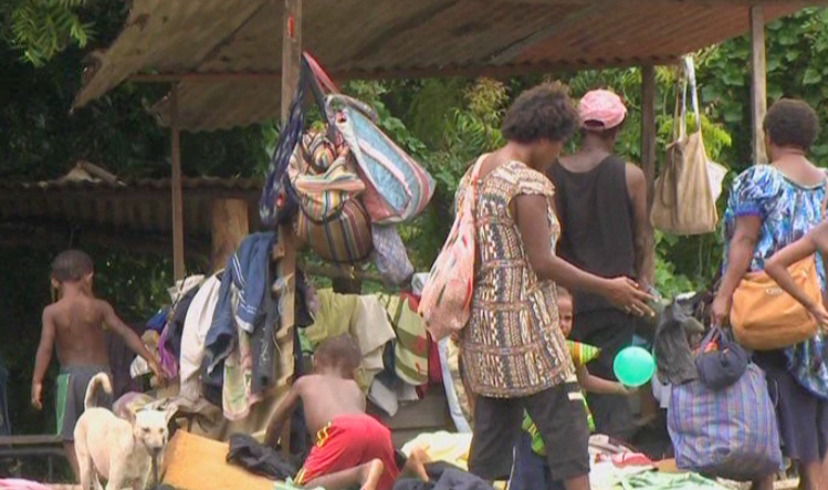
Over 200 families residing in Erima Bridge were evicted and left sleeping out in the open without food or water in February 2017. Photo: EMTV, 06/02/2017 (date accessed 06/02/2017)
The current drive to evict communities living around Jacksons Airport is the latest in a series. In February 2017 police evicted more than 200 families who were living on state-owned land in Erima Bridge. Some of them had lived in makeshift and semi-permanent housing for more than 20 years. The officer in charge of Jacksons Airport said the police were acting on the orders of the land owned by the NAC and that over the course of a week all the houses and tents in the area in question had been removed. It was reported that they were left sleeping out in cold, wet weather conditions for a few days. Their only shelter was wooden frames and roofing iron and they had no food, water or clothing. A settler who had moved to Erima from the Highlands region said some people whose homes were destroyed had not received an eviction notice. At the time of the Erima Bridge eviction the Asian Development Bank (ADB) confirmed support for expansion of Jacksons Airport, signing an agreement with NAC to develop a new international passenger terminal. In May 2015 a demolition exercise at another settlement near Jacksons Airport, 7 mile, left more than 200 people homeless. Some of them were beaten up by the eviction squad. Evictees lost all they owned during the demolition and some homes were burned down. The eviction was part of NAC’s development plan for Jacksons Airport.
In 2003 construction of an international airport in Sikhuphe, Swaziland was initiated by King Mswati III, who rules the country as sub-Saharan Africa’s last absolute monarch. From its inception commentators warned that the new airport was a waste of resources, diverting funding away from vital projects to fight poverty in Swaziland. In contrast with the one in seven of the coutnry’s inhabitants living in abject poverty King Mswati III enjoyed a lavish lifestyle with 13 palaces, fleets of luxury cars and a private jet.
September 2021 satellite imagery of King Mswati III International Airport and some of the surrounding road network
In March 2014, presiding over an expensive opening ceremony, King Mswati III unveiled the name of the new airport: King Mswati III International Airport. In the lead up to this event he had announced that a new town would be established to support the new airport, which would bring development to the surrounding communities, including Mbadlane, Hlane and Malindza. He proclaimed “After a radius of about five kilometres from the airport, urban structures will be constructed.” More than three years later, in October 2017, the Times of Swaziland reported that King Mswati III International Airport had ‘brought nothing but misery to hundreds of residents of Sikhuphe, in Malindza, where the airfield was constructed’. They had not received any compensation for their relocation, despite a consultant’s recommendation that a sum of approximately US$6 million be allocated for resettlement of 188 homesteads falling within the boundary of the so-called ‘airport city’.
There was a series of protests over impacts of airport and road construction and lack of compensation in 2021. In September, Malindza residents protested disruption of their water supply caused by construction of a road serving the airport, and demanded its restoration. They had been left struggling to access water to sustain their cultivation of vegetables and rearing of livestock after a dam was destroyed by Inyatsi, a firm with close connections to the government which was awarded construction contracts for King Mswati III International Airport along with a major highway connecting South Africa to Mozambique via the airport. In November a group of about 200 residents blocked Inyatsi’s trucks from entering the quarry near King Mswati III International Airport. It was their third protest in three months. In November 2021 some of the residents of Malindza who were displaced to make way for the project and whose houses were damaged by blasting works during construction – of the airport and road leading to it – were still demanding compensation. Blasting had caused cracks in their houses. A group of residents, mainly women, protested for almost a week and camped in the bushes. They had lost patience after struggling for compensation for almost 20 years.
Over 200 residents slept in the bushes demanding compensation for damage to their housesduring construction of King Mswati III Airport. Photo: Swaziland News, 12/11/2021
This case of airport-related injustice is documented on EJAtlas, the world’s largest online database of social conflict around environmental issues: King Mswati II International Airport
In the early days of the Covid-19 pandemic, on 15th April 2020, officials from the Indonesian government and the East Java province attended a virtual groundbreaking ceremony for a new airport in the Kediri regency. The event marked the official start of construction works that had actually begun three months earlier in January when heavy machines were levelling soil, following several delays that were partly caused by some affected residents refusing to release their land for the project due to unpaid compensation. Fewer than 20 families, in the villages of Bedreck and Bulusari, remained in the area. A villager told The Jakarta Post “If we accept the price, we won’t be able to buy land and build a house of similar value to what we have now”. She said none of the villagers wished to hamper development of the airport, they simply wanted fair compensation. The Kediri administration said that only 0.6 per cent of the 400 hectares of land required to build the airport had not been acquired.
Kediri Airport site area, April 2018
Kediri Airport site area, satellite imagery, June 2020
Kediri Airport site area, satellite imagery, November 2020
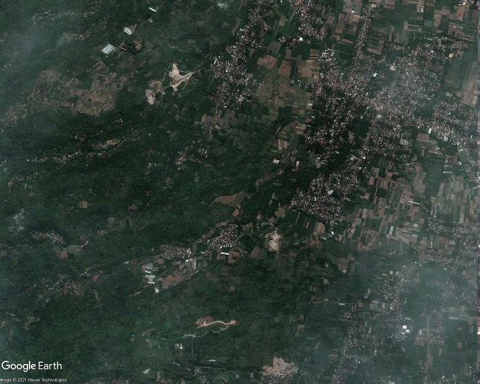
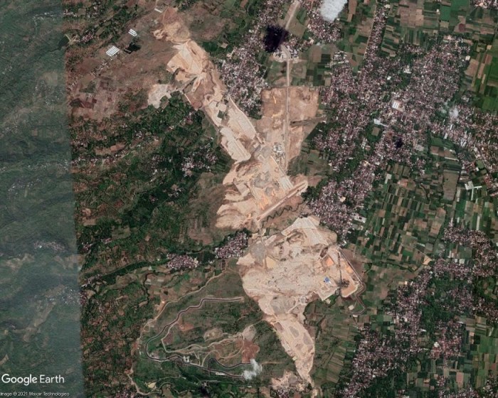
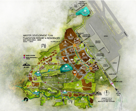
The Kediri Airport project (also referred to as Dhoho Airport) was approved in 2018. The first of the satellite images above shows the airport site area in April 2018, consisting of villages and farmland. The second image shows the same area in June 2020 after earthworks had levelled large areas of land. The third satellite image is from November 2020, by which time earthworks had progressed and impacted upon a larger area, transforming the landscape from verdant green to a pale expanse of crushed and compacted rock. Adjoining this area, extending to the southwest, additional earthworks and construction of roads can be seen. This airport-adjacent development is shown in the fourth and final image in the slideshow, a graphic of the Kediri Master Plan visualising a future tourism and residential complex in this area. Produced by ARKDESIGN Architects and Planners, the ‘MASTER DEVELOPMENT PLAN, PLANTATION RESORT & RESIDENCES’ shows two commercial development areas, a warehouse, utility complex and parking adjoining the airport terminal and cargo buildings. Extending to the southwest is an area allocated for hotels, residences and various tourism facilities including five lakes. Progress of construction of the one of these artificial lakes, near the centre of the planned development, can be seen in the satellite images. The graphic indicates proximity to Mount Wilis, a solitary volcanic massif amidst the surrounding low-lying plains. The route of a future toll road is shown extending from the southeast of the project site, between the airport and the adjacent development.
Controversy over land acquisition for Kediri Airport dates back to 2017, when residents, aware of large-scale land acquisition, questioned whether it was a government or private project. In March 2019 residents of one of the affected villages, Jatirejo, hung dozens of banners along village roads, stating their refusal to accept the prices offered by land buyers for agricultural land, that they said were too low. In October 2019 37 head of family residents of Bedrek Selatan hamlet, Grogol village, had not released their land for the airport project as they had not agreed compensation. The airport plan had caused the price of land around the project site to soar. Land prices had also gone up in Bulusari village where some residents were confused over where to relocate to. Some who had received compensation were experiencing difficulties in finding places to relocate to because of soaring land prices. A shift in the location of the airport runway had required acquisition of additional land, leaving residents with difficulties finding land to relocate to. In January 2020 45 residents of Grogol village rejected land acquisition, protesting over a drop in the compensation offer that would only be sufficient for them to buy land in far away suburbs. Residents’ coordinator said they were being pressured to give up their land for the airport. In February 2020, just two months before the groundbreaking ceremony, some residents had still not agreed to the compensation offers for land acquisition. Ten families were refusing eviction because, while the price of land in their village had dropped drastically, the price of land in new locations where they might settle had risen; they faced the prospect of a huge loss. A resident of Bedrek spoke of repeated visits by land buyers over several months and being pressured to accept the price offered for land.
At the time of writing some residents are still unwilling to leave their homes and suffer the impacts of airport construction works. Several villages – Tarokan, Tiron, Bangkan, Jatirejo and Grogol – have been demolished for the airport project and most of the inhabitants had left. Tugiyem, one of few villagers remaining in Mbandrek Selatan, spoke in the midst of swirling dust and roaring engines of construction vehicles, staring at a pile of dredged rocks. She had lived there since the 1960s and used to work gazing livestock, but her animals were left dying as the construction company had fenced off the land and she could not reach them. A metal fence erected on one side of Grogol, ostensibly to deter trespassing and reduce pollution from construction works, limits residents’ access to their village. One of the main roads connecting Grogol village has been blocked off to aid construction works. This had forced farmers taking their crops to the city to take longer routes and food stalls and shops near the road had to shut down. Within a month of closing access to the road four shops had gone bankrupt. Owners of surviving shops have to rely on custom from their neighbours, including Siti Anggirawan who was forced to close her textile shop. Waiting for customers outside her grocery store, Sri Katun said air quality in Grogol had deteriorated, “When a strong wind blows, construction dust drifts into the house. I often cough.” But she had no thoughts of giving up the land she had bought after years of saving up money, saying, “This house is witness to my ups and downs alongside my husband. We want to die on this land that has been part of our history.”
Earthworks for the airport project consisted of a cut and fill excavation up to 35 metres high. Rivers are being diverted away from the runway via two enormous box culverts, one 570 metres in length and the other 470 metres, made from reinforced concrete. A 3,300 metre runway is being built, to acommodate the largest world’s largest aircraft such as the Boeing 777 and Airbus A350. Construction of the airport proceeds even though plummetting air traffic since the start of the Covid-19 pandemic casts doubts on the feasibility of traffic predictions. And the projections for Kediri Airport, as reported in ACI World Airport Development News, Issue 4 2020, are ambitious. Upon completion of the first phase of construction, scheduled for April 2022, Kediri Airport is projected to handle 1.5 million passengers per annum, eventually rising to more than 10 million annually. A Transport Ministry offical said Kediri Airport would serve domestic flights for tourism, and might also be used for cargo related to possible future agricultural and industrial activity in East Java. Kediri Airport is the first in Indonesia to be fully funded by the private sector. Tobacco company Gudang Garam will spend up to USD732 million to acquire 457 hectares of land and a subsidiary, Surya Dhoho Investama, will oversee development of the airport.
The first section of a two-part video, Aerotropolis: Evictions, Ecocide and Loss of Farmland, highlights damaging impacts of aerotropolis (airport city) projects on people and the environment. Allocation of large sites means that communities face displacement and entire ecosystems can be destroyed.
The video looks at 14 aerotropolis-type projects: New Yogyakarta International Airport, Kertajati Airport and Aerocity, Kualanamu Aerotropolis (Indonesia), 2nd Jeju Airport (South Korea), New Phnom Penh Airport (Cambodia), Long Thanh Aerotropolis (Vietnam), Taoyuan Aerotropolis (Taiwan), KXP AirportCity (Malaysia), Andal Aerotropolis, Bhogapuram Airport and Aerocity, Shivdaspura Aerocity (India), Anambra Airport City (Nigeria), Tamale Airport (Ghana) and Western Sydney Aerotropolis (Australia). For further information see the comprehensive Reference list of source material, including photos and other images.
A proposed aerotropolis in Malaysia, KXP AirportCity, is one of a number of strategic infrastructure projects under the Northern Corridor Economic Region (NCER) Strategic Development Plan 2021-2025. The project, also referred to as Kedah Aerotropolis, comprises a new airport, Kulim International Airport and Sidam Logistics, Aerospace and Manufacturing Hub (SLAM). The Kedah Aerotropolis page on the NCER website describes an aerotropolis as ‘a metropolitan subregion whose infrastructure, land use and economy are centred on an airport’. It states that the proposed development would take up 9,841 acres (3,983 hectares) of land and that ‘KXP has readily available land that can cater for its expansion for the next 20 to 50 years’. Images in the sildeshow below show: a map of the proposed KXP AirportCity site with associated road development including a new expressway interchange, an aerial image with a digitised boundary of the proposed site, predominantly consisting of farmland, and a Kedah Aerotropolis infographic.
The Kedah state government appointed KXP AirportCity Holdings (KAHSB) to manage and coordinate construction of Kulim Airport. In February 2020, after witnessed a signing ceremony between the CEO of KAHSB and Aeroport de Paris Ingenierie (ADPI), the firm appointed to draw up a development master plan for KXP, Kedah Menteri Besar (Chief Minister) Mukhriz Mahathir invited airport investors, operators and concession holders to invest in the project. He said “The risks of uncertainties regarding land acquisition have been settled” and announced that 3,982 hectares of land had been gazetted to KXP and the Federal Government had approved a “large loan facility” for Kedah to acquire the land, currently belonging to private owners.
But land acquisition for KXP AirportCity met with a protest by villagers concerned they would lose their land and livelihoods. Many Pantai Cicar villagers were concerned that land they had lived on for almost a century could be lost as it was within the area earmarked for construction of the airport city project. On 28th February 2020 about 300 residents of Pantai Cicar village gathered in front of the mosque to protest against land acquisition for the proposed KXP project. The chairman of a village action committee said the earmarked land included more than 200 houses, the mosque that had been built by the community and the cemetary where their ancestors were buried. Implementation of the airport project would impact upon residents whose main livelihoods are from rubber tapping, working on palm plantations and self-employment.
On 28th February 2020 about residents of Pantai Cicar village protested against proposed construction of KXP AirportCity / Kulim Airport in their village, Sinar Hinan, 2nd March 2020
A video of the 28th February protest against taking Pantai Cicar village land for KXP AirportCity shows a large gathering of people. Some of the banners at the protest are written in English and read:
OUR LAND FOR NEXT GENERATION AND NOT FOR NEW AIRPORT, WHY NEED TO CONSTRUCT NEW AIRPORT AT TRADITIONAL VILLAGES
DON’T TAKE OUR BELOVED VILLAGE, AVOID THE KXP, FROM OUR VILLAGE, MOVE THE KXP TO THE PKNK OWN PROPERTY
DON’T DISTURB OUR COMMUNITY WITH NEW AIRPORT PROJECT
OUR LAND FOR NEXT GENERATION AND NOT FOR NEW KXP CITY & AIRPORT
WE LOVE STAY UNITY. PLEASE DON’T DEVIDE US WITH SPLIT SETTLEMENT, WE DO NOT NEED NEW AIRPORT AT THIS MOMENT
WE LOVE STAY UNITY. PLEASE DON’T DEVIDE US WITH SPLIT SETTLEMENT, DEALING WITH BIAS NOT OUR CULTURE!
At the time of the protest preparations were underway to hand over a memorandum containing almost 1,000 residents’ signatures to the state government. In addition to Pantai Cicar several nearby villages were also listed in the proposed land acquisition: Kuala Sedim, Jerung, Kemumbong, Lubuk Kiab, Batu Pekaka and Tanah Licin. The local government and housing committee chairman said the Kedah state government would investigate and review the project’s impact on the environment, saying planning was just beginning and there would be a discussion session.
Since a Kulim airport project was being considered in 2014 there has been an emphasis on potential air cargo operations. In December 2014 Mukhriz said the Kedah state government planned to construct an ‘aerocity’ at the proposed Kulim Airport; an industrial and business area, located on what was at that juncture specified as a 600 hectare airport precinct, would “accommodate all industries related to air transportation”. In March 2015 Mukhriz said Kulim Airport would initially operate as a cargo facility. In November 2020 KXP was described as ‘an airport city that will be an integral part of the Kedah Aerotropolis economic region driven by intermodal connectivity focussing on cargo, logistics and industrial development’. It is envisaged that Kulim Airport’s cargo facilities and the development of the aerotropolis will be complemented by the Sidam Logistics, Aerospace and Manufacturing Hub (SLAM).