Construction of an ‘Eco-Tourism Airport’ on Koh Rong island

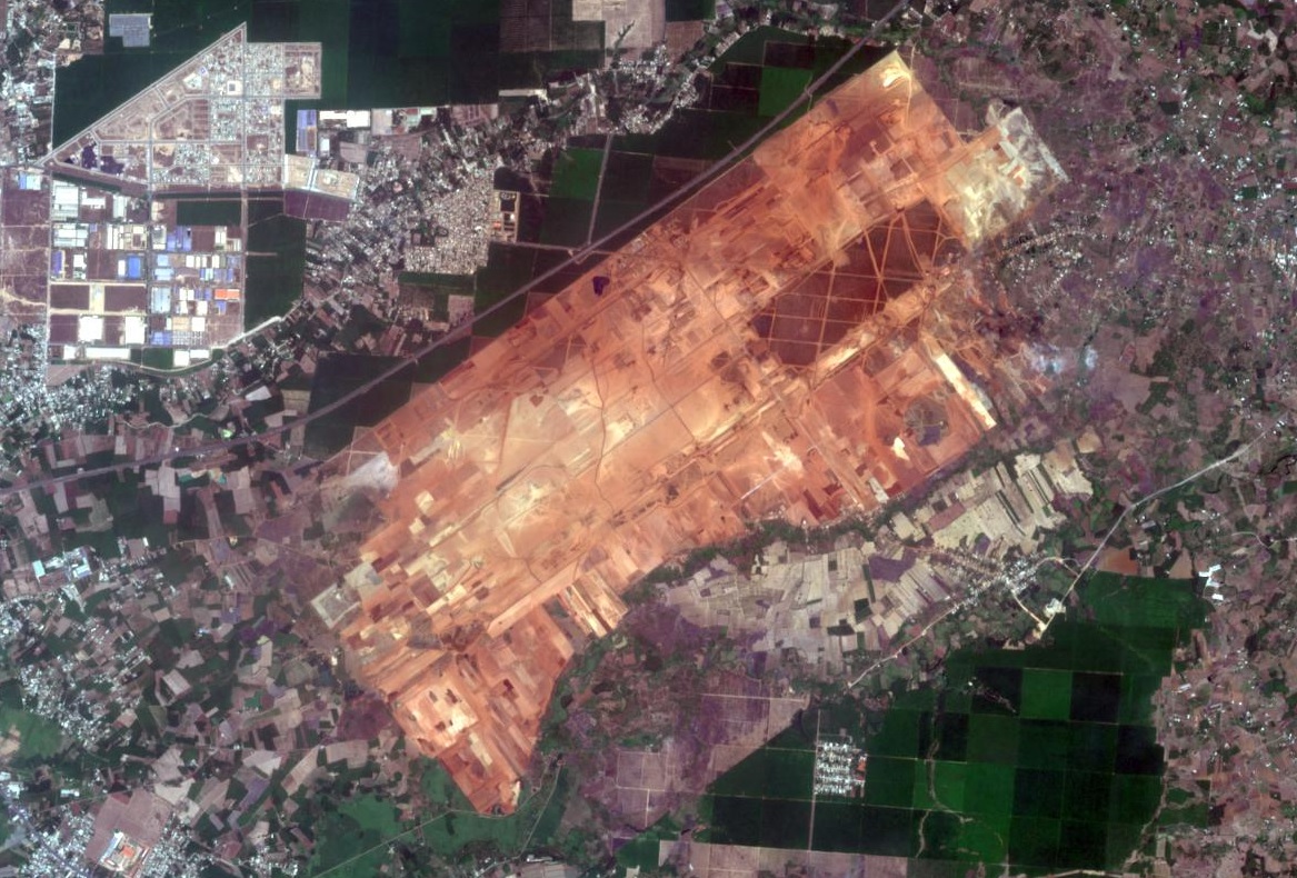
Earthworks for construction of an airport on Koh Rong island, 25 km from the city of Sihanoukville on Cambodia’s south-west coast, began in January 2024. Satellite imagery shows the airport site, located in a flat area in the centre of the island. The new airport with a 2.650 metre runway will have capacity to handle 138,000 passengers annually upon completion of the first phase and the MoU signed in January 2023 formalised a budget of $300 million. The necessity and viability of Koh Rong International Eco-Tourism Airport seems questionable with two major international airports nearby. Newly constructed Dara Sakor Airport, with capacity for 10 million passengers per annum and scheduled to begin operations in November 2024, is only 21km away. Sihanouk Airport is 45 km away. Also, Koh Rong is already well served by boat; the ferry journey from Sihanoukville only takes about 45 minutes.

Satellite imagery of Koh Rong dated 1st November 2023, showing location of the four coastal villages, Royal Sands resort, long beach, major roads and Koh Rong International Eco-Tourism Airport construction site.

The new airport will be named ‘Koh Rong International Eco-Tourism Airport’. While an airport enables people to visit and explore protected beaches, forests and native wildlife habitats, it does the very opposite of protecting ecosystems, concreting over a vast area for runways, terminals and access roads. Then there is the issue of climate disrupting greenhouse gas emissions from flights, with aviation being energy intensive and dependent upon fossil fuels. And tourism development on Koh Rong has damaged ecosystems and the people depending on them. In 2008, Royal Group, one of the largest investment and development companies in Cambodia, was granted a 99-year land concession to develop the 78 square kilometre island. Realisation of the masterplan – featuring resorts, casinos, marinas, golf courses, two fishing villages and an airport – was delayed but commenced in 2015 with clearance of sites along the southwestern coast including forests along with construction of a road. On 3rd July 2015 Koh Touch villagers held a sit-in protest, blocking construction crews, excavators and a bulldozer, in response to construction of a road which they said would cut through their village and affect their homes. Later that month opposition to development of Koh Rong became more vocal in response to construction equipment and workers appearing on the island. Hundreds of residents began to speak out on social media. As well as cutting trees cliffs and rocky outcrops had been flattened for development, including a new pier on Long Beach, on the southeast of the island.

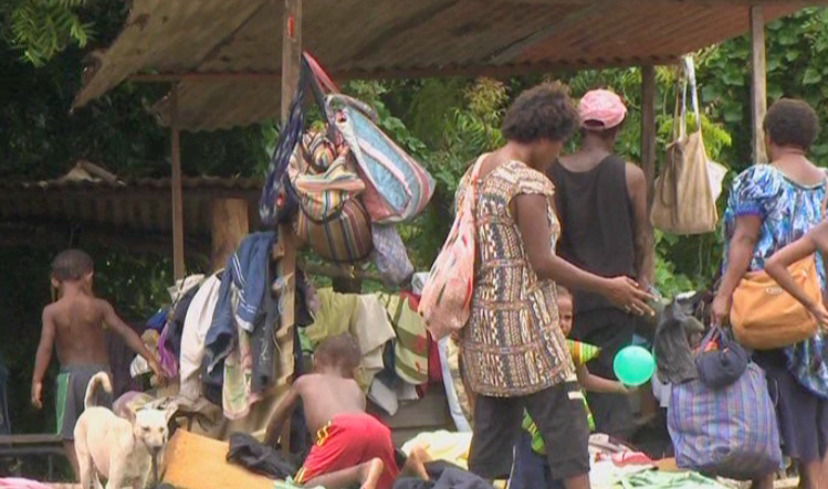
In August 2015 a number of Koh Kong residents called on officials to review what they called “abusive activities” by Royal Group. Construction had accelerated in recent weeks and workers and machinery had been photographed clearing large areas of forest. Residents accused Royal Group of destroying farmland and crops, including cashew, jackfruit, coconut and mango trees. A village leader said destruction could impact the livelihoods of over 100 families, who had lived on the island since 1995. Villagers said the destruction of their livelihoods was illegal and authorities should monitor the situation. Human rights and environmental campaigners supported residents’ calls for improved oversight and local groups were preparing petitions and other documents to file with provincial and national authorities. Protest groups had been formed in response to a breakdown in communications between residents and Royal Group. One villager said, “They come in and do their work, take whatever they want, but there is no communication”. 

Controversy over land titles for Koh Rong villagers was reported in 2017. Some residents who had lived on the island since before 2008 had land titles, although it was uncertain whether these titles would be upheld amid disputes. Those arriving after 2008 did not have land titles. By 2018 over 1,000 land plots, belonging to 500 families, had been recognised by the government, but in April 2018, during the inauguration of the luxurious, five-star Royal Sands Koh Rong resort, about 50 people who had not yet received land titles attempted to join the event but were prohibited from doing so. Prime Minister Hun Sen ordered the Ministry of Land Management to bring an end to the Koh Rong land dispute. In June 2020 53 families protested land clearance; a 35-hectare site they believed rightfully belonged to them was being bulldozed. A Preah Sihanouk Provincial Administration spokesperson called on the protesting families to cooperate with authorities by providing relevant documents and warned them that if they caused chaos legal action would be taken against them. A member of one of the protesting families claimed they had lived in the area since 1992 and said: ”We won’t go anywhere. I will gather to protest at this site. We dare not enter the bulldozing site. I want Prime Minister Hun Sen to see and tackle this issue for us. We all have ownership documents.”

In June 2024 Mongabay reported that a new map of Royal Group’s plans for Koh Rong showed golf course zones, commercial zones, accommodation zones, casinos zones and an international airport. The latest plans did not appear to impact fishing villages but included clearing some of the Koh Rong’s protected forests to make way for golf courses. In total, project plans entail clearing more than 3,100 hectares of the island’s forests. A photo showed bulldozers and trucks working on the airport site. Sixteen years after the land was leased to Royal Group there was still no publicly available social or environmental impact assessment and islanders’ future was uncertain. Some Koh Rong residents hoped to sell their land to Royal Group while others feared that it would be taken from them.

For more information about the airport and tourism projects on Koh Rong island, including references for all source material, see the case study on EJAtlas, the world’s largest, most comprehensive online database of social conflict around environmental issues: Koh Rong island tourism development, Cambodia.

Pacific Airport displaces communities, destroys agriculture and is intended to serve a planned Bitcoin City

In Conchagua, El Salvador, the Condadillo and Flor de Mangle communities are being displaced from their homes and farmland for construction of Pacific Airport. A linked ‘Bitcoin City’ on the slopes of an inactive volcano has yet to materialise.

Pacific Airport location map with respect to environmental zoning
Location of Pacific Airport project with respect to environmental zoning, Ministry of the Environment and Natural Resource (MARN), 09/2021. Source: Mala-Yerba

El Salvador’s Legislative Assembly approved a new law expediting procedures for building the Pacific Airport on 26th April 2022, allowing the Autonomous Executive Port Commission (CEPA) to acquire title to property deemed necessary. In June 2022 the Earth Journalism Network reported that vegetation was being cut to make way for the airport and eucalyptus trees had been marked for felling. Inhabitants who cultivated crops said government personnel had entered the land to cut plants, without reaching a sale agreement as had been promised. In November 2022 Mongabay reported that the airport faced backlash from local communities after breakdown of negotiations with the government. Residents said they were being pressured to accept buyouts for their properties. Mala-Yerba reported that works on the airport site had begun at the end of February 2023, before the environmental permit was issued by MARN on 21st March. A source from Condadillo expressed concern over irreparable damage to trees, mangroves, animals, birds and aquifers. Flor de Mangle residents, depending on sea fishing and harvesting molluscs from the nearby El Tamarindo mangrove will also be impacted, as the area is a nursery for crabs, molluscs and other crustaceans and many residents make an income from collecting and selling them.

Residents of Condadillo and Flor de Mangle recounted workers entering agricultural and housing land plots with machinery, in the absence of authorisation from landowners or a court order. Drilling and excavation left the area unsuitable for agriculture and unsafe for people and livestock. Residents also denounced pressure from CEPA to sell land at unfair prices. Farming families and MILPA (Indigenous Movement for the Integration of the Struggles of the Ancestral Peoples of El Salvador) representatives said that more than 225 families had been directly affected by being unable to produce crops – including watermelons, tomatoes, grains and chillies. At the beginning of July 2024 MILPA stated that human rights violations against Condadillo and Flor de Mangle inhabitants impacted by construction of Pacific Airport had worsened. More than 225 families said their rights to consultation, legal advice and compensation had been violated. Many inhabitants reported being threatened and intimidated by CEPA.

New laws, tax exemptions and an “air-tropolis”

On 29th September 2021 MARN issued a statement that the Pacific Airport was not environmentally feasible and the Autonomous Executive Port Commission (CEPA) submitted a request to MARN for reconsideration. Within 24 hours the MARN website changed the status of the airport project to ‘high impact’. New environmental zoning and a new eminent domain law approved by the Legislative Assembly on 17th November 2021 made legal provision to continue the project. Then, on 26th April 2022 the Legislative Assembly approved a new law expediting procedures for building the Pacific Airport, allowing CEPA to acquire title to property deemed necessary for construction of the airport. It is estimated that the new airport will handle 1 million passengers per year, possibly rising to 3 million within 25 years. Construction of Pacific Airport, for civilian and military use, is expected to cost $500 million over 10 years. Purchases made within the framework of the airport project will be granted exemptions from income tax, Value Added Tax (VAT) and municipal taxes for 25 years. According to CEPA’s projections, the airport will bring poles of economic development to El Salvador’s eastern zone. CEPA president, Federico Anliker, said the airport terminal will be converted into an “air-tropolis”: a city with industrial plants, resort centres, hospitality and factories for export of technological products. For more information about Pacific Airport, including references for all source material, see the case study on EJAtlas, the world’s largest, most comprehensive online database of social conflict around environmental issues: Pacific Airport (Aeropuerto del Pacífico), El Salvador

An airport for a planned Bitcoin City

Pacific Airport is linked with the Bitcoin City project announced by President Bukele in November 2021, two months after El Salvador became the first country to adopt Bitcoin as legal tender. Bukele unveiled a model and graphics showing a coastal circular city (the shape of a Bitcoin) on the slopes of the volcano, crammed with golden skyscapers radiating from a central plaza with the Bitcoin logo, along with images of an airport. In February 2022 CEPA President Federico Anliker said, “Bitcoin City, well, is going to have its own airport”. The proposed Bitcoin City site is in an inactive volcano in Conchagua and plans include a bitcoin mining complex to be powered by a new geothermal plant. Environmentalist Ricardo Navarro, from Cesta Amigos de la Terra, expressed concerns over geothermal energy generation for Bitcoin mining, saying “The big problem is that it consumes a large amount of electricity”. Lourdes Molina of the Central American Institute for Fiscal Studies said, “Here it is not only the operation of the servers but also that they demand a lot of energy, they have to be at certain controlled temperatures to be able to work, we are talking about the almost industrial use of air conditioning.”

Funding for Bitcoin City is as uncertain as the energy supply. As of July 2024 the ambitious plans for Bitcoin City, compared by Bukele to Alexandria, have not materialised, the ground has yet to be broken. Construction was supposed to be part-funded by $1 billion in government-issued ‘volcano bonds’ with a portion of the earnings to be invested in geothermal energy facilities. Initially scheduled to go on the market in February 2022, several deadlines were missed, most recently in the first guarter of 2024. The government has not announced an alternative source of funding for Bitcoin City. Bitcoin was central to Bukele’s promises of prosperity; three years after it became legal tender few citizens use it. Bitcoin was promoted as a way of making savings on fees for remittances from the US, but only 1.3% of remittances were sent through crypto wallets in the three year period and the amount of saved fees has not been disclosed. The future of Bitcoin City, anticipated to bring in an influx of wealthy crypto investors and returning expats buying luxury apartments and paying no income or property taxes, seems to depend upon construction of Pacific Airport. However, Bitcoin city could be revived by another transportation project. Turkish port operator Yilport Holdings has made the pargest private investment in El Salvador, committing $1.6 billion to two port projects, La Unión, near the Bitcoin City site, and Acajutla. which is the country’s main seaport.

Dara Sakor Airport serves tourism zone taking up 1/5 of Cambodia’s coastline

In November 2023 Cambodia’s State Secretariat of Aviation (SSCA) announced that construction of Dara Sakor Airport (Cambodia’s fourth international airport after Phnom Penh Airport, Siem Reap Airport and Sihanouk Airport) was in its final stages. Dara Sakor Airport has been built to serve a gigantic tourism-oriented economic zone, the 451 square kilometre Dara Sakor project encompassing about one-fifth of Cambodia’s coastline. The Dara Sakor developer, Coastal City Development Group Ltd., calls the project ‘Coastal City’ and its website has pictorial maps indicating the many components of the project such as Dara Sakor Airport, a resort, tourism zone, golf courses and a port. The China-Global South Project reflected on the Dara Sakor project in 2023. Of all the anticipated infrastructure only the airport was completed. Yet the project continued with ‘considerable support from the government’. BBC reporters visiting Dara Sakor in September 2023 described unfinished roads and buildings as a stark contrast with ‘dazzling brochures for potential investors’.

Pictorial map of Dara Sakor project including tourism zone, resort, golf courses, development zone and Dara Sakor International Airport. Source: Coastal City Development Group Ltd.

Thousands of people have been forcibly displaced from their homes for the Dara Sakor project, losing their farming and fishing livelihoods. There have been many protests against eviction and inadequate compensation, in many instances met with repression. Unrest dates back to the inception of the project in 2008 when 360 sq km of land in the Botum Sakor and Kiri Sakor districts in the Koh Kong Province was reclassified as state-owned land. A 99-year lease contract was signed with Union Development Group (UDG) of China. Cambodian Human Rights and Development Association (Adhoc) reported that affected communities were not consulted about the project, some only becoming aware when officials arrived to measuring land. In 2011 the project site grew to 451 sq km when UDG was granted an additional 91 sq km land concession to develop a water reservoir and hydropower. During 2011 UDG began dismantling and burning down some villagers’ houses and destroying productive trees.

A key protest took place in February 2014 when about 140 people blocked the road to UDG’s offices leading to a clash with 40 UDG security guards and six soldiers carrying AK-47 rifles. Kiri Sakor District Governor said district authorities had ordered about 100 families to vacate their land for the Dara Sakor project’s hotels, golf courses and an airport. By September 2014 5,791 people had moved to a relocation site where they lacked access to former farming and fishing areas and suffered many problems including poor quality housing damaged by wind and rain, limited water that did not meet national standards, lack of electricity and health care facilities. Reports of destruction of houses and productive trees emerged again in 2018. In april April Koh Kong Provincial Court heard testimony from 13 families claiming that 60 UDG guards had burned their productive trees, seeking compensation for loss of cassava, jackfruit, mango, rubber and coconut crops.

On 27th May 2019 about 20 residents protested in front of the Chinese Embassy in Phnom Penh, calling for resolution of the 11-year land dispute. A report by the Community Legal Education Center stated that 1,143 families were forced to vacate about 100 sq km of land in the first five years fo the project but many families had resisted and fought for rights to the land. Four villagers were detained for 12 hours on 29th September 2020, after camping outside Koh Kong Provincial Hall calling for action over the 12-year land dispute with UDG. A year later 1,333 families rejected compensation offers of between 1 and 3.5 hectares and said they would fight to remain on their land. Protests against compensation offers continues into 2022; some declined the offer as it was insufficient and the village the government wanted to relocate people to was 100 km away and lacked infrastructure.

In June 2023, just four months before SSCA’s announcement about construction of Dara Sakor Airport entering its final stages, there was yet another protest by people affected by displacement for the Dara Sakor project. A group of villagers involved in a Dara Sakor related land dispute attempted to travel to Phnom Penh to submit a petition at the Ministry of Justice, but were met with a police roadblock. Eleven villagers were arrested, forced into a truck, returned to Koh Kong and charged with criminal incitement. Radio Free Asia reported that authorities threatened further arrests after about 20 villagers gathered outside the offices where the 11 people were being detained. Human rights organization Licadho said the protesters had not caused any social disorder and that police had been sent to the the area where many of them lived.

For more information including references for all source material see the case study on EJAtlas, the world’s largest, most comprehensive online database of social conflict around environmental issues – Dara Sakor project, Cambodia.

Dust pollution from levelling Long Thanh Airport construction site

Long Thanh Airport, under construction in the Đồng Nai Province, is slated to be Vietnam’s biggest airport. With a 5,000 hectare site and costing USD16 billion the airport is designed to have capacity to handle 100 million passengers and five million tonnes of cargo per annum. High levels of dust pollution from levelling Long Thanh Airport construction site, caused distress and posed health risks for neighbouring communities. Between April and October 2022 inspections by Đồng Nai Department of Natural Resources and Environment found dust pollution at the site up to 18 times higher than permitted levels. Levelling works entailed digging up and filling and flattening vast volumes of soil and trucks carrying soil on the site stirred up clouds of dust. In December 2022 more than 1,800 vehicles and machines were operating on the airport site. By the end of March 2023 residents of neighbourhoods near Long Thanh Airport construction site had been shrouded in dust for several months. Satellite imagery dated 13th March 2023 showed progress of the levelling works.

Long Thanh Airport site, 13/03/2023
Long Thanh Airport site 13/03/2023. Image credit: Esri, European Commission, European Space Agency, Amazon Web Services

One place worst affected by dust was the primary school at the heart of the Binh Son Commune. Doors were kept closed for the entire day but dust still seeped in. “It’s impossible to clean” said a school security guard, “the dust is everywhere and comes at all times.” A teacher at the school said pupils’ books were “terribly dirty”. Pupils’ hands were always red and they were not comfortable with wearing face masks. Ten people cleaned the school three times every day but dust got into every corner. Some households attempted to keep dust out with canvas tarpaulins or plastic sheeting. A local resident said before airport construction started air quality in the area had been good, but now it was “unbearable”. Another resident said it would be another two of three years until the airport is completed and they “could not bear the red dust”. The deputy chairman of the Vietnam Lung Association said exposure to dust on a daily basis can severely affect people’s health, causing damage to the lining of the respiratory tract or leading to pneumonia, lung infection or pulmonary fibrosis.

Green roofs were coated in red dust and residents spoke of dust on every surface. Farmers in Binh Son Commune grappled with pervasive red dust from the airport construction site. Dust had stuck to mangosteen and rambutan leaves just as the trees began to bear fruit. One farmer said his durian trees had not developed properly and more than half of the fruit had fallen. He and other farmers attempted to wash their trees, spraying them with water which was of limited effectiveness. Another farmer cleaned his trees from 2am to 8am each day, consuming a lot of water and electricity. Other crops were affected, including jackfruit, lychee, banana and sapodilla. Red plumes rose like fires from the construction site and dust was carried by the wind, turning the sky red and impacting on people living at some distance from the construction site, including in the Loc An-Ninh relocation area, a resettlement site for people displaced to make way for Long Thanh Airport. A blanket of dust hung in the air extending as far as 10 kiometres from the site.

A video filmed on the airport site in March 2023 shows a red dust ‘tornado’, a large, dense, rotating plume of dust. You can hear the rumbling sound of the tornado. Clouds of dust are generated when a bulldozer pours red soil into a truck. Footage from a moving vehicle shows areas of the site under a heavy haze of dust and trucks pumping water onto part of the site.

Efforts to address the dust problem, such as spraying water and deploying trucks to dampen the ground to reduce airborne dust, had been ineffective. Officials noted that the size of the site, the dry season and windy weather exacerbated the dust problems. Beginning in April 2023 dust mitigation measures were increased with construction of 10 reservoirs, each with capacity to store 3,200 cubic metres of water, to supply water for 60 trucks including two firefighting trucks. It was also announced that air conditioners would be installed at some schools near the construction site, to prevent dust from entering classrooms.

For more information see the case report on EJatlas, the world’s largest, most comprehensive online database of social conflict around environmental issues: Dust pollution from Long Thanh Airport construction, Vietnam. In April 2023, after publication of the case study, ACV was fined VND180 million (US$7,670) for dust pollution during construction of Long Thanh Airport, plus an additional fine of VND90 million (US$3,835) for failure to implement the environmental impact assessment report.

Demolitions for ‘airport zone’ (zone aéroportuaire Modibo Kéita), Mali

Mass evictions for an ‘airport zone’ next to Modibo Keita Airport, Mali’s main airport on the outskirts of Bamako, the capital city, began on 20th April 1995. Without warning, the government began bulldozing the Senou neighbourhood to make way for expansion of the zone. Demolitions continued for ten days and about 3,707 families, approximately 30,000 people, were forcibly evicted. Further waves of demolitions followed with many instances of land grabbing and speculation. Farmers were displaced for a fertilizer plant on the land in 2007-8 and in 2009 residents resisted instructions to leave the land. A drive to clear remaining communities began in 2021. Bulldozers arrived early in the morning of 14th January, in a major eviction drive covering 1,600 hectares; about 20,000 families in 11 neighbourhoods were impacted. About 800 evictees said they had permits to occupy the land and many affected people were left destitute without shelter.

zone aéroportuaire Modibo Kéita
Map showing zone aéroportuaire Modibo Kéita. Source: https://journals.openedition.org/eps/docannexe/image/7707/img-3.png

The ‘airport zone’ – zone aéroportuaire Modibo Kéita – is vast, extending over 7,194 hectares northwest of the airport. It was classified as a plot of land for airport company use in 1999. Residents contest government claims that their occupation of the airport zone is illicit; they have lived on the land for several generations. An inhabitants’ organization – Plateforme deshabitants de la zone dite aéroportuaire (PHZA) – has been established with active groups, sometimes holding different views about land management, in many affected villages. Women, some of them elderly, play a prominent role in resistance against eviction from the ‘so-called airport zone’. The land struggle is supported by l’Union des Associations et Coordinations d’associations pour le Dévelopement et la Défense des Droits des Démunis (UACDDDD), a national federation fighting the injustices of dispossession. Demonstrations and meetings about the airport zone have been attended by hundreds of people. In November 2021 an independent national commission of inquiry to investigate demolitions in the airport area was established.

For more information about the Modibo Keita airport zone evictions see the case report on EJatlas, the world’s largest, most comprehensive online database of social conflict around environmental issues: Modibo Keith airport zone, Mali

New Phnom Penh Airport land dispute enters fifth year

Disputes over land acquisition for New Phnom Penh Airport date back to 2018 when 2,600 hectares, in the Kandal Province, were allocated for the project. With an estimated cost of US$1.5 billion the development was described as one of the world’s largest airports by land area with an adjoining ‘Airport City’. The site is predominantly agricultural land and villagers were shocked by sudden news of the airport and the prospect of losing homes, land and livelihoods from farming and fishing. A series of protests between February and June 2018 involved hundreds of people, representing about 2,000 families, complaining of low compensation offers, intimidation during negotiations over land and encroachment onto communally held wetlands. By December 2019 foundations for the airport were being laid.

Protest continued into 2020. In June the Kandal Stung district governor said 2,000 plots of land were affected by airport construction and in August villagers from the Kandal and Takeo provinces whose farmland fell within the planned site petitioned the Prime Minister requesting a bigger payout from the airport developer. By May 2021 construction of New Phnom Penh Airport was reported to be 40% complete, with the terminal hall, airfield and 100 metre high control tower already in place. A State Secretariat of Aviation (SSCA) spokesperson said, “We are aware that the pandemic has disrupted many projects and the economy, but the construction of the airport in Kandal Province and other airport projects in the country have been on schedule.” The map below, dated 17th July 2021, shows satellite imagery of part of the airport site and communes impacted by land acquisition including Ampov Prey, Boeng Khyang and Kandork.

New Phnom Penh Airport construction site, satellite imagery 17th July 2021

The land dispute escalated on 14th May 2021 when approximately 200 people who said their rice crops had been destroyed set up a protest camp blocking a road to the construction site. They set up tents and a few days later several of them surrounded a bulldozer and demanded proper compensation for their land and crops. Residents were still blocking bulldozers from clearing farmland in July and authorities warned journalists against covering the land dispute. On 7th September about 50 villagers attempted to block National Road 2 in protest against development of New Phnom Penh Airport. They were confronted by about 100 security officers but the standoff remained non-violent. Then police set up roadblocks to prevent villagers from inspecting land they had been displaced from. A representative of Kampong Talong village (shown to the south of the map) said villagers were being prevented from seeing land that had been seized for airport construction. They had ceased cultivating the land three years ago but economic hardship, due to business shutdowns during the Covid pandemic, had driven them to start farming it again as they had been left without other ways to survive.

On 12th September 2021 a ‘clash’ between about 100 protesters and about 400 police left 13 officers and an unknown number of protesters injured. Kandal provincial police dispersed the protests with teargas and about 30 people were arrested and detained. Nine of the arrested people were accused of violence – specifically being in possession of sticks stones and slingshots, hurling gasoline and burning tyres. In February 2022 a dozen excavators were digging up rice fields and wetland in Boeng Khyang and dozens of police and military officials were dispatched to ensure implementation of authorities’ instructions to carry out the works. The nine protesters charged with violence were acquitted in November 2022. At this time the number of villagers impacted by land acquisition increased; about 200 people demanded to know whether they would be joining the 300 families already being displaced for the airport. Numbers were sprayed in red paint on dozens of houses alongside the 94 canal, located about 5km from the airport site. Then in January 2023 residents affected by the airport development said company workers had instructed them to dismantle sheds housing animals, causing anxiety that their land might be cleared. Representatives of 460 families living around the airport project had requested land titles the previous month but received no response.

For more information about the airport land dispute see the case write-up on EJAtlas, the world’s largest, most comprehensive online database of socio-economic conflict related to environmental issues: New Phnom Aiport and Airport City, Kandal Province, Cambodia

Demolition of +300 houses on Kasompe Airstrip land

On 20th August 2022, beginning at 2am, more than 300 houses built on land surrounding Kasompe Airstrip were demolished by officers from Chingola Municipal Council and the Zambia Police Service. The Council stated it had not allocated the land in question and the buildings had been erected without planning permission. Residents appealed to the government to find them alternative land and some of them attempted to resist the demolition, burning tyres and breaking the windows of bulldozers. A video of the demolition shows houses in plots of land with gardens and trees being bulldozed, as displaced people looked on.

Completed houses as well as houses still under construction were demolished. A number of residents retaliated against destruction of their homes, setting fire to two properties – a guesthouse and servants’ quarters – owned by Johnson Kang’ombe, Mayor of Chingola, whom they accused him of selling them plots of land at Kasombe Airstrip. Two suspects thought to be involved in the arson were apprehended and detained. A group of women protested chanting slogans including “The Mayor must go”. One evicted woman said that her aunt whose home was also demolished had collapsed with suspected high blood pressure.

In the aftermath of the demolitions the only help given to displaced residents was food aid and space in a camping site, provided by the Chingola District Disaster Management and Mitigation Unit (DMMU). On 29th August it was reported that Chingola District Commissioner Raphael Chimupi had said that DMMU had given relief food items to 95 out of 98 families whose houses had been demolished. Chingola Member of Parliament Chipoka Mulenga visited affected residents and promised to help them, saying “I will do everything in my power to help resolve this issue, it is saddening to see a lot of houses demolished, which has left many families in the cold.” Mulenga said the government would provide alternative land to the victims of the demolition of 345 houses, but as of 27th September 2022 some people were still stranded with nowhere to relocate to.

Satellite imagery of an area at the eastern end of the Kasompe Airstrip runway, dated 26th July and 8th September, shows some of the buildings which were destroyed on 20th August 2022. Slide the bar between the images below to compare the area before and after the demolitions.

The land conflict, inustice and human rights violations related to Kasompe Airstrip is documented on EJAtlas, the world’s largest, most comprehensive online database of social conflict around environmental issues. Kasompe Airstrip is located on the eastern outskirts of the city of Chingola, in the Copperbelt Province, a mineral rich area that is the main copper mining region in Zambia. President of the Equity and Economic Party, Chilufya Tayali, said information had surfaced indicating that the demolition of the houses was not driven by the purported illegality of allocation on plots of land but by foreign interests in a mine near Kasompe Airstrip. Aerotropolis-type plans were mentioned in 2019 when the then Mayor of Chingola, Titus Tembo, said Chingola aims to become a city with Kasompe Airstrip being part of this agenda.

The Zambia Air Force (ZAF) denied allegations that it has influenced or pressured Chingola Municipal Council to demolish the houses on Kasompe Airstrip land. ZAF Director Public Relations Lieutenant Colonel Helen Chota said rumours were incorrect and that none of the other ZAF airstrips had been encroached. Yet the day after the demolitions, on 21st August 2022, it was reported that ZAF Commander Lieutenant Colon Barry had alerted citizens to more house demolitions across the country, saying houses and other structures built within 500 metres of airport infrastructure would be demolished and that building civilian structures on or near airports is a threat to national security.

Aerocity catalyst for Little Andaman plan

Airport development features heavily in a plan for tourism-oriented megaprojects on Little Andaman Island, the southernmost island of the Andaman archipelago. Graphics below, from the 58-page ‘Sustainable Development of Little Andaman Island – Vision Document’, show: Zone 1, on the eastern coast, featuring an Aerocity, housing an international airport, envisaged as ‘the catalyst for development of the district’; Zone 2, on the southern coast, including a Leisure Zone and Tourism SEZ (special economic zone) with casinos, theme park and beach hotels; Zone 3, on the western coast, a Nature Zone containing super-luxury resorts and hotels, with an airstrip for private charter flights.

  • Little Andaman plan
  • Little Andaman plan indicating 3 zones
  • Map of Zone 1 of Little Andaman plan. The Aerocity is the catalyst for developmen

Sudden news of the plan, in January 2021, alarmed conservationists. The ‘Vision Document’, thought to have been finalised a few months previously but not in the public domain, is included in ‘A MONUMENTAL FOLLY: NITI Aayog’s Development Plans for Great Nicobar Island (An evolving archive of reports, information and documents)’, compiled by Panjaj Sekhsaria and published by Kalvpavriksh Environmental Action Group. The total project area is nearly 240 sq km, 35% of the island; the three zones would take up 107 kilometres of the island’s coastline. Development of this scale would have major impacts on indigenous people and the island’s unique biodiversity and forests. Little Andaman is home to the Onge tribe, living on the island for more than 50,000 years, the population dwindling since 1900. Now numbering an estimated 125 people the Onge tribe is categorised as one of India’s Particularly Vulnerable Tribal Groups (PVTG). According to the plan the Onge Tribal Reserve would be reduced by 31%; the Vision Document states that steps would be taken to relocate and protect Onge people but no detail is given. An anthropologist pointed out that bringing areas where Onge, with nomadic origins, do not live into the proposed development would still impact them, saying “the Onges have a close attachment with their territory be it inhabited or not”.

The Divisional Forest Officer of Little Andaman raised concerns that the major diversion of forest land for the project would cause irreversible damage to the island’s forests, entailing the loss of more than 2 million trees. An official source said there are over 2.4 million trees in the “vast tract of forests” in the areas where development is proposed. Removal of trees would cause topsoil erosion and reduce rainfall, impacting on the small area of the island with cultivable soil. Uprooting more than 2 million trees for the Little Andaman plan would also result in carbon emissions and carbon stock losses. Carbon pools were calculated for the four forest types in the development areas: nearly 136 sq km of Evergreen/Semi Evergreen and smaller areas of Deciduous, Swamp/Mangrove and Plantation forests. A study estimated that implementation of the ‘Sustainable Development of Little Andaman – Vision Document’ would result in carbon stock loss of 2,996.286 tonnes from five categories of carbon pools: 55% from woody debris and soil organic matter, 32% from above ground living biomass, 9% from below ground biomass, 3% from dead mass of litter and 1% from dead wood.

Nesting sites of Giant Leatherback Turtles, the world’s largest turtles growing over 6 feet in length, with many populations in precipitous decline, are threatened by the Little Andaman plan. South Bay and West Bay on Little Andaman are both high-intensity nesting sites and among the most important in the entire island chain. Along with other nesting beaches on the islands, the two sites are specifically mentioned as ‘Important Marine Turtles Habitats in India’ in the National Marine Turtle Action Plan. There are fears that implementation of the ‘vision’ would push the leatherback turtles to the brink of extinction. A 2019 report on a long-term monitoring programme at Little Andaman island identified previously unknown migratory routes of Great Leatherback Turtle nesting in the region, highlighting their dependence upon foraging and nesting sites that are thousands of kilometres apart. Nine tracked turtles traversed much of the Indian Ocean, as far southeast as Western Australia and towards the eastern coast of Africa. The turtle travelling the furthest, close to the western coast of Mozambique, covered 13,237km in 266 days; it was also the fastest, travelling an average of 49.8km per day.

More information about the Little Andaman plan has been published on EJatlas, the world’s largest, most comprehensive online database of social conflict around environmental issues: Little Andaman Development Plan

Long term land tensions over Nadzab Airport Redevelopment Plan (NARP) and Airport City

Plans for airport city style development at Nadzab Airport – located 42km to the northwest of Lae, capital of the Morobe Province and Papua New Guinea’s second largest city – emerged in a 2011 masterplan for future growth of the airport both as an aeronautical hub and as a commercial and industrial centre. Nadzab Airport’s extensive land holding was earmarked for development and expansion over a time-frame of 50-70 years. The graphic below, showing a business hub next to the airport, is from Nadzab Central Strategic Plan, produced by Planpac and identifying development opportunities for 700 hectares of greenfield land.

Nadzab Central Strategic Plan. Graphic: PLANPAC
In 2012 PLANPAC developed a Strategic Land Use Masterplan for Nadzab Central Strategic Plan, a business hub next to Nadzab Airport, with 700 hectares of greenfield land on a 1,100 hectare site. Graphic: PLANPAC

Tensions between clans over ownership of land parcels date back to the inception of the airport project, in 1972 when the country was under Australian colonial administration. A loan agreement between the Japan International Cooperation Agency (JICA) and the PNG government – for ¥26,942 million (USD225.2 million) of an estimated project cost of ¥32,246 million (USD269.6 million) – was signed on 14th October 2015 and the project came to be known as Nadzab Airport Redevelopment Plan (NARP). Plans for an Airport City were mentioned in 2017 and in February 2020 NARP project manager said it was a major airport and city development and the provincial government must help address landowner issues. Prime Minister James Marape tasked Lands and Planning Minister John Rosso to start mobilising landowners in preparation for the project. In April 2021 PNG National Airports Corporation (NAC) managing director and chief executive Rex Kiponge said that upon completion of NARP the airport city concept would be rolled out, saying “When the airport is complete, the commercial aspects of the airport business hub must complement it.”

The village of Gabsongkeg is at the centre of NARP and landowners have made repeated calls for consultation, participation in the project and spin-off business opportunities. In 2020 landowners were disappointed that construction and security contracts were awarded to outsiders overlooking reputable local businesses. In January 2022 it was reported that only a small number of landowners were benefitting from leasing their customary land for associated businesses. Local people impacted by airport development still lack clean running water, electricity and adequate health facilities. NARP and other projects, such as a 4-lane highway and gold and copper mining, have triggered an influx of people, disrupting the social fabric and leading to increased social problems including violence, killings and drug & alcohol abuse. The area lacks a police station to address these issues.

Serious social problems of rape, underage marriage and prostitution specifically harm women. And women have been marginalized in land-related negotiations and decisions due to government assumptions of patrilineal land descent. Yet in the midst of these difficulties 60 Gabsongkeg women – planning ahead as most of the land in Gabsongkeg where coconut, plantain, cocoa and other trees are cultivated, is set to be taken over by the Nadzab township development – have established table markets selling food and other goods. They have increased their incomes and aim to grow their ventures into small-medium sized enterprises to support their families in the future.

Further information about contested land and other issues arising from Nadzab Airport has been published on EJatlas, the world’s largest, most comprehensive online database of social conflict around environmental issues: Nadzab Airport Redevlopment Plan (NARP) and Airport City, PNG

Evictions of communities close to Jacksons Airport

A drive to evict informal settlers living on parcels of land around Jacksons Airport, Papua New Guinea’s main airport located to the northeast of Port Moresby, was announced in the early days of 2022. Residents of the Saiwara community protested being issued with several eviction notices over the past year by the National Airports Corporation (NAC), the most recent giving them until the end of the month to vacate the area. A petition against the eviction was signed by 5,000 residents and a representative stated that they had been paying a traditional landowner for the land. Many tax-paying small and medium sized enterprises (SME’s) also urged the government to stop the evictions. A video by EMTV Online shows men, women and children protesting, some holding up placards with statements such as ‘No Eviction Please’, ‘No Eviction, What is Government doing For My Future’.

In January 2022 residents of the Saiwara community next to Jacksons Airport protested eviction notices issued by the National Airports Corporation (NAC)

Simultaneous with the eviction drive in Saiwara, NAC began pressuring residents to vacate Erima, another area adjacent to Jacksons Airport. A group of policemen visited communities and issued eviction notices. A long term resident said, “Police said the land close to the airport belongs to the National Airports Corporation and people must move out before the eviction date.” NAC managing director Rex Kiponge stated that the land belonged to NAC and that people must vacate the land by the end of January. He said, “I personally witnessed and heard from the police that any settlement or houses near the airport must be immediately moved out of force will be applied” and urged people living in the affected area to find a place to resettle.

Graphic from video showing parcels of land surrounding Jacksons Airport that the National Airports Corporation (NAC) lays claim to and where residents have been served with eviction notices. Image: Saiwara Eviction Notice, EMTV Online, 11/01/2022

A graphic in the EMTV Online video shows the parcels of land surrounding Jacksons Airport that the NAC lays claim to and where residents have been served with eviction notices. NAC managing director Rex Kiponge explained that the eviction drive was a strategic move to utilize the land for a non-aeronautical revenue stream, i.e. generation of revenue from sources other than airlines. (Typical sources of non-aeronautical revenue include retail, hotels, tourism facilities, business premises, real estate and car parking.) Kiponge also mentioned another hallmark characteristic of an aerotropolis/airport city: aspiriations for an airport to become a destination in its own right. He said that eviction of people from land around Jacksons Airport would support NAC’s new policy, namely ‘Converting Airports from Point of Transit to Point of Destination’. NAC’s focus on development of land for non-aeronautical purposes has been galvanised by a collapse in its revenue stream due to the drastic reduction in air traffic since the Covid-19 pandemic. Previously, NAC’s revenue had consisted of 80% from aeronautical business and 20% from non-aeronautical business. Kiponge said the NAC needed to start generating its own revenue and recouping its assets was in line with this aim.

Following questions in Parliament from member for Moresby North East, John Kaupa, PNG Prime Minister James Marape intervened, assuring settlers on airport-owned land at Erima and Saiwara that they would not be evicted by the NAC until a permanent solution was reached. He asked NAC to freeze their eviction plan. But the settlers are still under pressure to leave; Marape warned them not to move in onto state land and start building structures if they are not in possession of titles, saying that the Government would not step in to assist anyone on humanitarian grounds.

Over 200 families residing in Erima Bridge were evicted and left sleeping out in the open without food or water in February 2017. Photo: EMTV, 06/02/2017 (date accessed 06/02/2017)

The current drive to evict communities living around Jacksons Airport is the latest in a series. In February 2017 police evicted more than 200 families who were living on state-owned land in Erima Bridge. Some of them had lived in makeshift and semi-permanent housing for more than 20 years. The officer in charge of Jacksons Airport said the police were acting on the orders of the land owned by the NAC and that over the course of a week all the houses and tents in the area in question had been removed. It was reported that they were left sleeping out in cold, wet weather conditions for a few days. Their only shelter was wooden frames and roofing iron and they had no food, water or clothing. A settler who had moved to Erima from the Highlands region said some people whose homes were destroyed had not received an eviction notice. At the time of the Erima Bridge eviction the Asian Development Bank (ADB) confirmed support for expansion of Jacksons Airport, signing an agreement with NAC to develop a new international passenger terminal. In May 2015 a demolition exercise at another settlement near Jacksons Airport, 7 mile, left more than 200 people homeless. Some of them were beaten up by the eviction squad. Evictees lost all they owned during the demolition and some homes were burned down. The eviction was part of NAC’s development plan for Jacksons Airport.

Information about evictions of communities surrounding Jacksons Airport has been published on EJatlas, the world’s largest, most comprehensive online database of social conflict around environmental issues: Jacksons Airport and evictions from land claimed by National Airports Corporation, PNG